MyTopo
Brooks Wisconsin US Topo Map
Couldn't load pickup availability
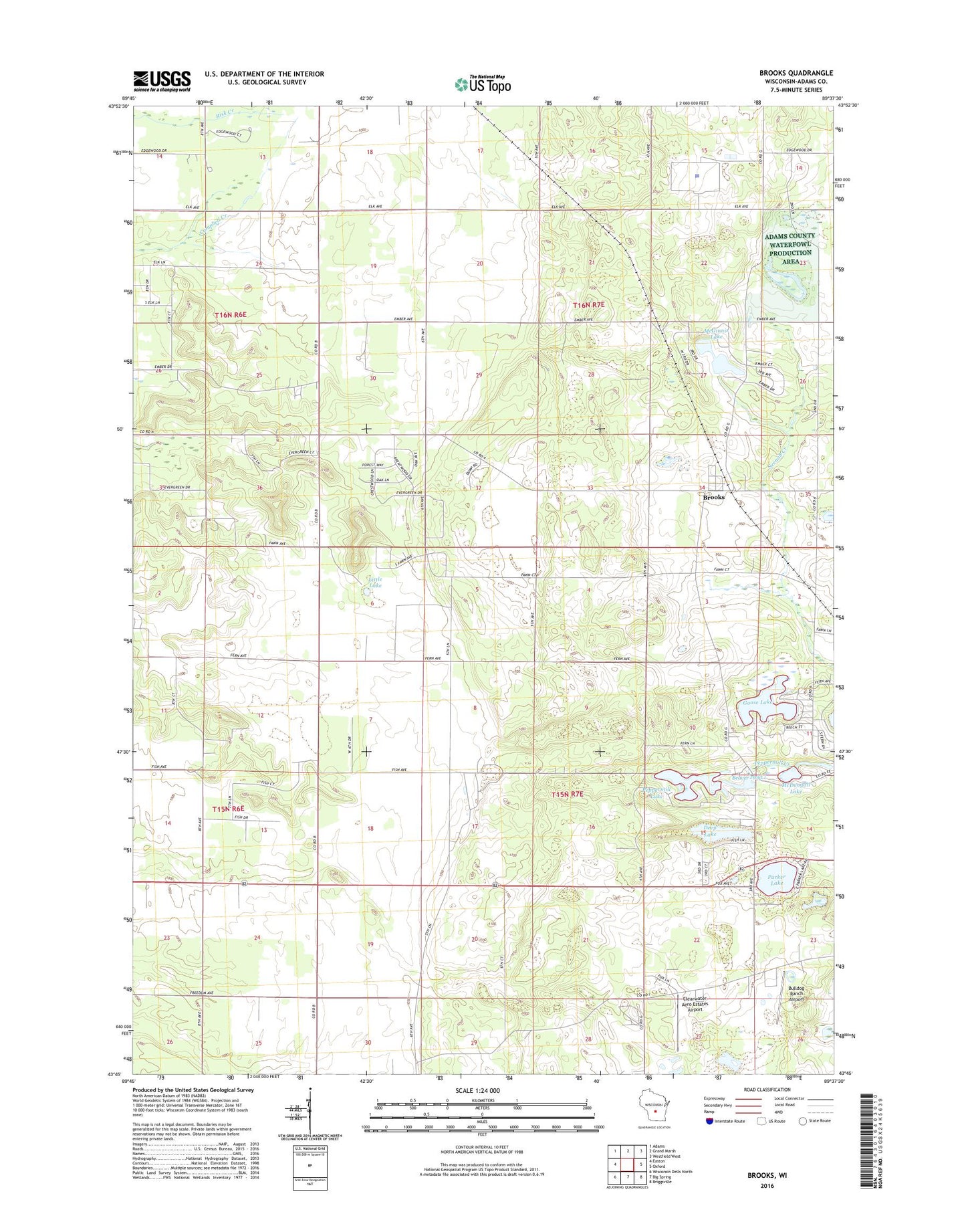
2022 topographic map quadrangle Brooks in the state of Wisconsin. Scale: 1:24000. Based on the newly updated USGS 7.5' US Topo map series, this map is in the following counties: Adams. The map contains contour data, water features, and other items you are used to seeing on USGS maps, but also has updated roads and other features. This is the next generation of topographic maps. Printed on high-quality waterproof paper with UV fade-resistant inks.
Quads adjacent to this one:
West: Easton
Northwest: Adams
North: Grand Marsh
Northeast: Westfield West
East: Oxford
Southeast: Briggsville
South: Big Spring
Southwest: Wisconsin Dells North
This map covers the same area as the classic USGS quad with code o43089g6.
Contains the following named places: Adams County Waterfowl Production Area, Beaver Pond 1, Brooks, Brooks Bluff State Natural Area, Bulldog Ranch Airport, Camp Oak Hill, Clearwater Aero Estates Airport, Coddington Dam 2WP2383, Deep Lake, Federal Correctional Institution Oxford, Goose Lake, Little Lake, McDougall Lake, McGinnis Lake, McGinnis Lake 2WP2255 Dam, New Chester, New Chester Church, Parker Lake, Peppermill Lake, Town of Jackson, Town of New Chester, Upper Neenah Creek State Fishery Area, ZIP Code: 53936