MyTopo
Casco Wisconsin US Topo Map
Couldn't load pickup availability
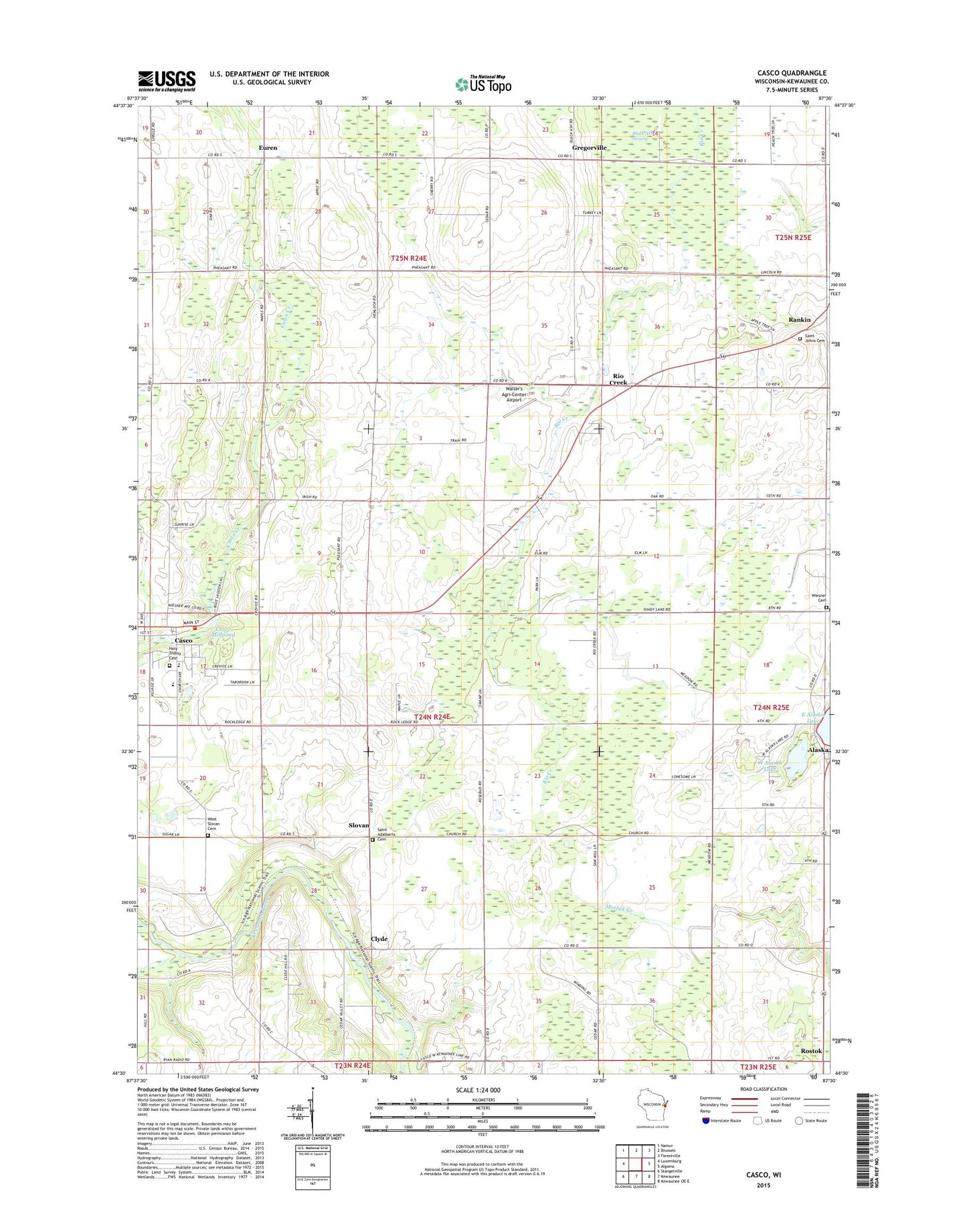
2022 topographic map quadrangle Casco in the state of Wisconsin. Scale: 1:24000. Based on the newly updated USGS 7.5' US Topo map series, this map is in the following counties: Kewaunee. The map contains contour data, water features, and other items you are used to seeing on USGS maps, but also has updated roads and other features. This is the next generation of topographic maps. Printed on high-quality waterproof paper with UV fade-resistant inks.
Quads adjacent to this one:
West: Luxemburg
Northwest: Namur
North: Brussels
Northeast: Forestville
East: Algoma
Southeast: Kewaunee OE E
South: Kewaunee
Southwest: Stangelville
This map covers the same area as the classic USGS quad with code o44087e5.
Contains the following named places: Alaska, Casco, Casco Millpond, Casco Post Office, Casco Town Cemetery, Casco Volunteer Fire Department, Casco Wastewater Treatment Plant, Clyde, El Na Farms, Euren, Gregorville, Harvest Acres, Holy Trinity Cemetery, Holy Trinity School, Liberty School, Little Scarboro Creek, Lonesome Road Farms, Luxemburg - Casco Middle School, Pavlat Dairy Farms, Railside Dairy Farm, Rankin, Riedy Farms, Rio Creek, Rosebud School, Rostok, Ryan School, Ryans Corner, Saint Adalbert Cemetery, Saint Johns Cemetery, Saint Johns Evangelical Lutheran Church, Slovan, Strip Valley Dairy Farms, Tebon Sand and Gravel Pit, Teske Farms, Thayse Farms, Town of Casco, Valley High Farm, Village of Casco, Walter's Agri-Center Airport, West Alaska Lake, Wiesner Cemetery