MyTopo
Clinton Wisconsin US Topo Map
Couldn't load pickup availability
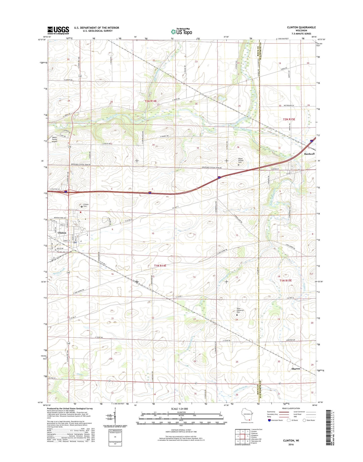
2018 topographic map quadrangle Clinton in the state of Wisconsin. Scale: 1:24000. Based on the newly updated USGS 7.5' US Topo map series, this map is in the following counties: Rock, Walworth. The map contains contour data, water features, and other items you are used to seeing on USGS maps, but also has updated roads and other features. This is the next generation of topographic maps. Printed on high-quality waterproof paper with UV fade-resistant inks.
Quads adjacent to this one:
West: Shopiere
Northwest: Janesville East
North: Avalon
Northeast: Delavan
East: Sharon
Southeast: Capron
South: Belvidere NE
Southwest: Belvidere NW
Contains the following named places: Allens Grove, Allens Grove Census Designated Place, Bardwell, Carver-Roehl County Park, Christ Evangelical Lutheran Church, Clinton, Clinton Cemetery, Clinton Elementary School, Clinton Fire Protection District and EMS, Clinton High School, Clinton Middle School, Clinton Police Department, Clinton Post Office, Clinton Village Hall, Clinton Water Works, Emmanuel Reformed Church, Exalt Him Fellowship Church, First United Presbyterian Church, Ladd Creek, Lang Immersion for Tomorrow School, Little Turtle Creek, Melin Farms Airport, Mount Phillips Cemetery, Pella Lutheran Church, Power Charter School, Rye Farms, Saint Catherine Cemetery, Spring Brook, Town of Bradford, Town of Clinton, Union Park, Village of Clinton, ZIP Codes: 53114, 53525