MyTopo
Shopiere Wisconsin US Topo Map
Couldn't load pickup availability
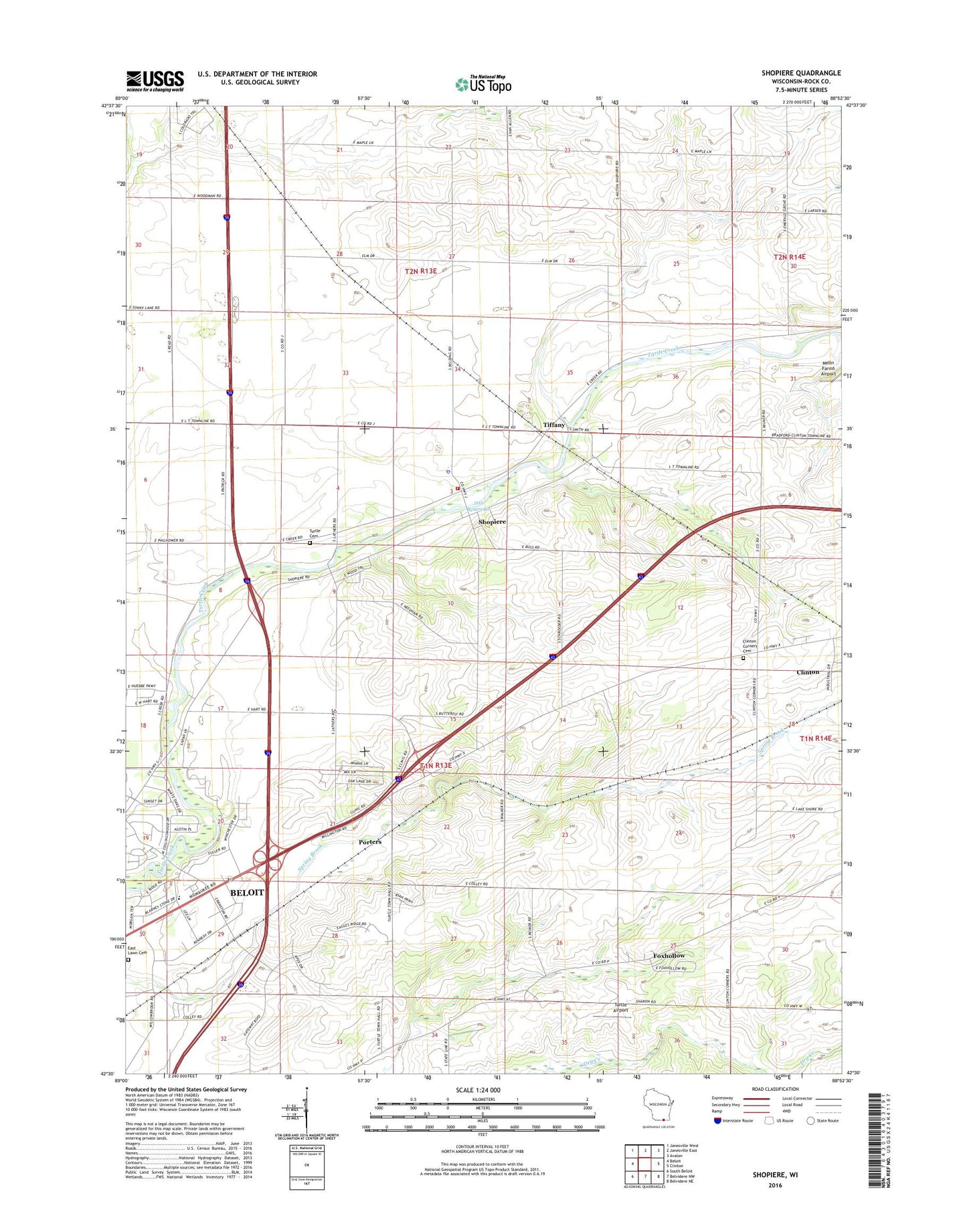
2022 topographic map quadrangle Shopiere in the state of Wisconsin. Scale: 1:24000. Based on the newly updated USGS 7.5' US Topo map series, this map is in the following counties: Rock. The map contains contour data, water features, and other items you are used to seeing on USGS maps, but also has updated roads and other features. This is the next generation of topographic maps. Printed on high-quality waterproof paper with UV fade-resistant inks.
Quads adjacent to this one:
West: Beloit
Northwest: Janesville West
North: Janesville East
Northeast: Avalon
East: Clinton
Southeast: Belvidere NE
South: Belvidere NW
Southwest: South Beloit
This map covers the same area as the classic USGS quad with code o42088e8.
Contains the following named places: 205 Reservoir, Arndt Farms, Arrowhead Orchards, Boutelle Quarry, Clinton Corners Cemetery, Clinton Sewage Treatment Plant, Dunn Quarry, Foxhollow, Morgan Elementary School, Porters, R And S Rolling Ranch, Schuster School, Shopiere, Shopiere Census Designated Place, Shopiere Dam, Sweet Allyn Memorial Park, Tiffany, Town of Turtle, Turtle Airport, Turtle Fire Department, Turtle Police Department, Turtleville, Turtleville Cemetery