MyTopo
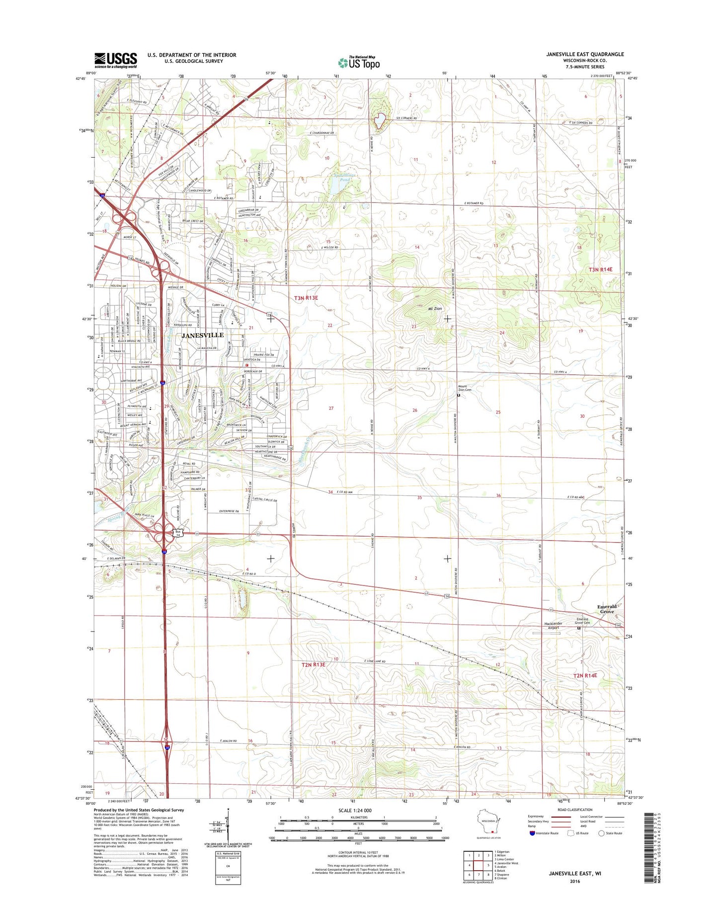
Janesville East Wisconsin US Topo Map
Couldn't load pickup availability
2022 topographic map quadrangle Janesville East in the state of Wisconsin. Scale: 1:24000. Based on the newly updated USGS 7.5' US Topo map series, this map is in the following counties: Rock. The map contains contour data, water features, and other items you are used to seeing on USGS maps, but also has updated roads and other features. This is the next generation of topographic maps. Printed on high-quality waterproof paper with UV fade-resistant inks.
Quads adjacent to this one:
West: Janesville West
Northwest: Edgerton
North: Milton
Northeast: Lima Center
East: Avalon
Southeast: Clinton
South: Shopiere
Southwest: Beloit
This map covers the same area as the classic USGS quad with code o42088f8.
Contains the following named places: Ardon Park, Bethel Baptist Church, Bjoin Quarry, Blackhawk Creek, Blackhawk Golf Course, Blackhawk Meadows Park, Blackhawk Park, Blackhawk School, Camp Rotamer, Cargill United Methodist Church, Christ Presbyterian Church, Emerald Grove, Emerald Grove Cemetery, Emmanuel Free Methodist Church, Georgetown Park, Good Shepherd Lutheran Church, Hacklander Airport, Hampshire Park, Harmony Elementary School, Harrison Elementary School, Hawthorne Park, Howarth School, Huron Park, Jackman Park, Janesville Fire Department Station 4, Janesville Mall Shopping Center, Janesville Medical Center, Janesville Virtual Academy, Jefferson Elementary School, Kennedy Elementary School, LaPrairie Park, Mandale Park, Marshall Middle School, Monroe Elementary School, Mount Zion, Mount Zion Cemetery, Mount Zion United Methodist Church, O'Leary Farms, Palmer Park, Rock Prairie Montessori School, Ruger Park, Saint Marks Lutheran Church, Saturn Park, Six Corners, Spauldings Pond, Town of Harmony, Town of La Prairie, United Church, Venable Farms, Woodland Christian School, ZIP Code: 53546