
MyTopo
Cloverland Wisconsin US Topo Map
Couldn't load pickup availability
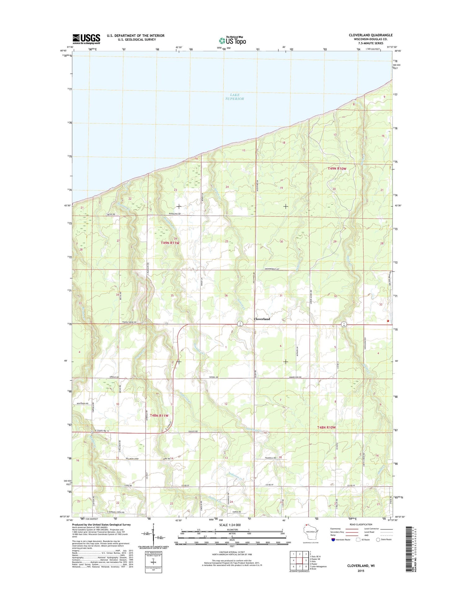
2018 topographic map quadrangle Cloverland in the state of Wisconsin. Scale: 1:24000. Based on the newly updated USGS 7.5' US Topo map series, this map is in the following counties: Douglas. The map contains contour data, water features, and other items you are used to seeing on USGS maps, but also has updated roads and other features. This is the next generation of topographic maps. Printed on high-quality waterproof paper with UV fade-resistant inks.
Quads adjacent to this one:
West: Poplar NE
Northeast: Oulu OE N
East: Oulu
Southeast: Brule
South: Lake Nebagamon
Southwest: Poplar
Contains the following named places: Anderson Creek, Bardon Creek, Bear Beach State Natural Area, Cloverland, Cloverland Volunteer Fire Department, Emmanuel Church, Fisher Creek, Haukkala Creek, Maple Church, Nelson Creek, Pearson Creek, Smith Creek, Town of Cloverland, ZIP Code: 54854


