MyTopo
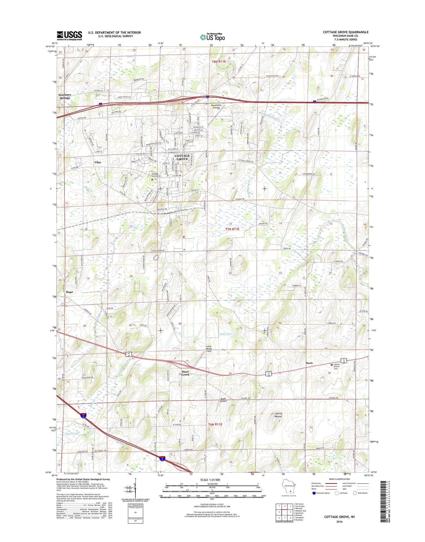
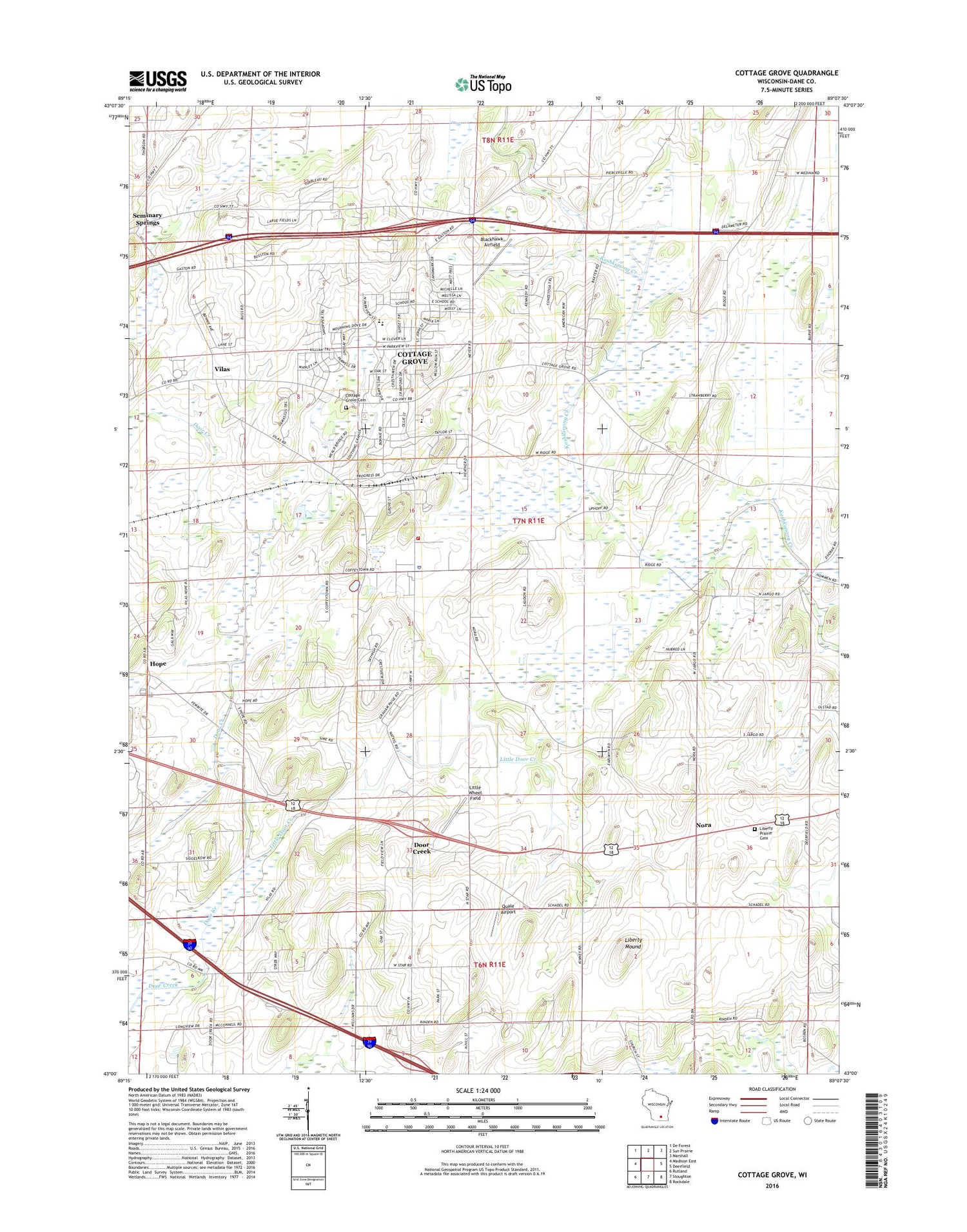
Cottage Grove Wisconsin US Topo Map
Couldn't load pickup availability
2018 topographic map quadrangle Cottage Grove in the state of Wisconsin. Scale: 1:24000. Based on the newly updated USGS 7.5' US Topo map series, this map is in the following counties: Dane. The map contains contour data, water features, and other items you are used to seeing on USGS maps, but also has updated roads and other features. This is the next generation of topographic maps. Printed on high-quality waterproof paper with UV fade-resistant inks.
Quads adjacent to this one:
West: Madison East
Northwest: De Forest
North: Sun Prairie
Northeast: Marshall
East: Deerfield
Southeast: Rockdale
South: Stoughton
Southwest: Rutland
Contains the following named places: Blackhawk Airfield, Cottage Grove, Cottage Grove Cemetery, Cottage Grove Police Department, Cottage Grove Post Office, Cottage Grove School, Cottage Grove Volunteer Fire Department, Deer - Grove Emergency Medical Service Station 1, Door Creek, Door Creek Cemetery, Door Creek Orchard, Highland Memory Gardens, Hoffman Corners, Hope, Hope Cottage Grove Cemetery, Hope Evangelical Cemetery, Jargo School, Kurt Dairy Farms, Liberty Mound, Liberty Prairie Cemetery, Little Door Creek, Little Wheel Field, Meinpferde Farm, Nora, Prairie Cemetery, Private Cemetery, Quale Airport, Saint Patrick's Cemetery, Salem Church Cemetery, Seminary Springs, Taylor Prairie School, Taylors Corners, Together 4 Kids School, Town of Cottage Grove, Vilas, Village of Cottage Grove, ZIP Code: 53527