MyTopo
Rutland Wisconsin US Topo Map
Couldn't load pickup availability
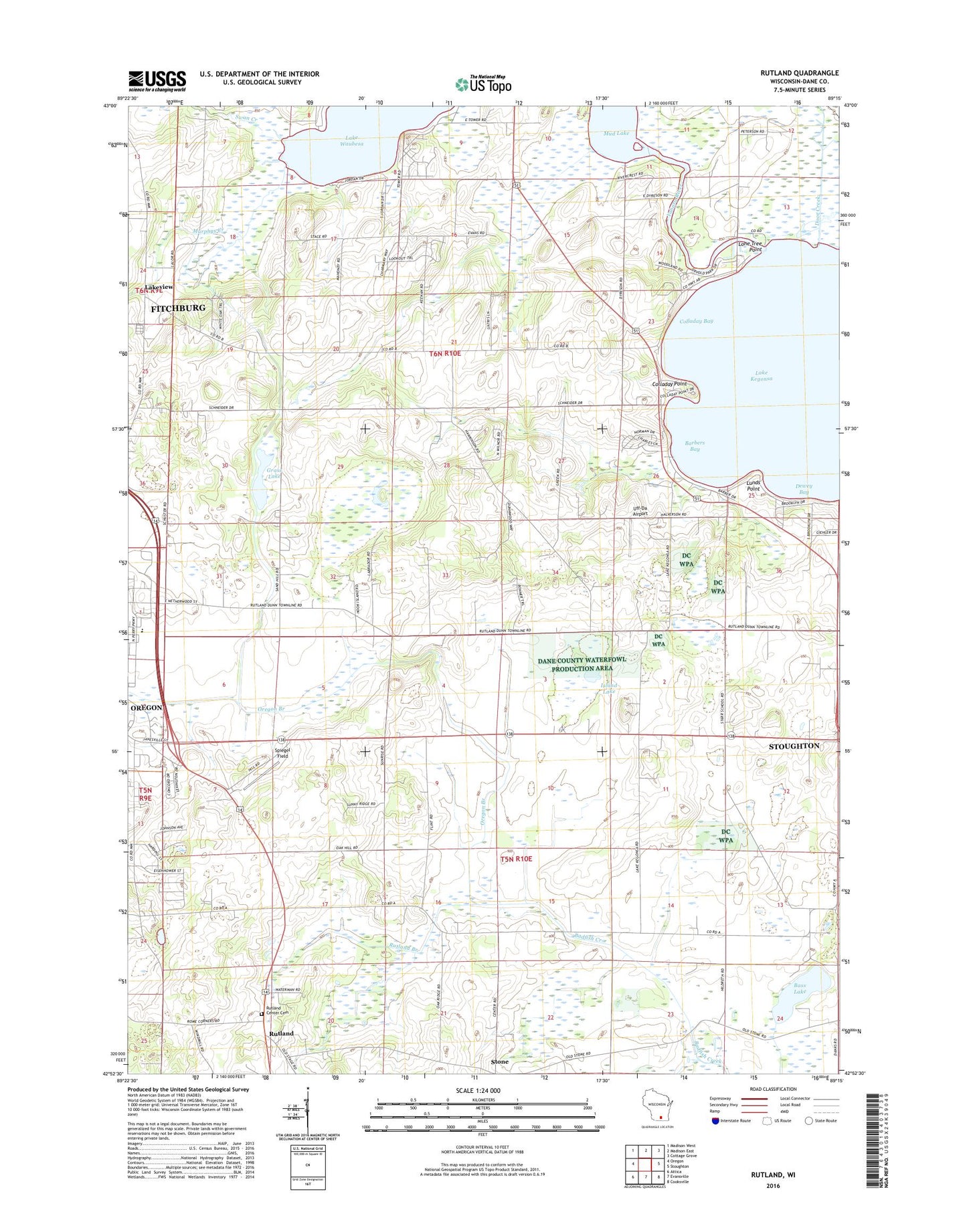
2022 topographic map quadrangle Rutland in the state of Wisconsin. Scale: 1:24000. Based on the newly updated USGS 7.5' US Topo map series, this map is in the following counties: Dane. The map contains contour data, water features, and other items you are used to seeing on USGS maps, but also has updated roads and other features. This is the next generation of topographic maps. Printed on high-quality waterproof paper with UV fade-resistant inks.
Quads adjacent to this one:
West: Oregon
Northwest: Madison West
North: Madison East
Northeast: Cottage Grove
East: Stoughton
Southeast: Cooksville
South: Evansville
Southwest: Attica
This map covers the same area as the classic USGS quad with code o42089h3.
Contains the following named places: Barbers Bay, Bass Lake, Bayview Heights, Century Trout Farm, Colladay Bay, Colladay Point, Dewey Bay, Door Creek, Grass Lake, Hook Lake, Hook Lake Bog State Natural Area, Island Lake, Jaycee Park, Lake Kegonsa, Lakeside School, Lakeview, Lone Tree Point, Lunds Point, Mandt Farm and Equestrian Center, Mc Manus Hoonch-Na-Shee-Kaw Airport, Mud Lake, Murphys Creek, Oakside School, Oregon Branch, Oregon Farm Center, Oregon High School, Quams Marina Seaplane Base, Red Bridge Crossing, Rutland, Rutland Branch, Rutland Center Cemetery, Saint Johns Lutheran Church, Spiegel Field, Swan Creek, The Flower Factory, Town of Dunn, Town of Dunn Burying Ground, Town of Rutland, Uff-Da Airport, Waubesa Wetlands State Natural Area, Willow Spring Farms, WTSO-AM (Madison), ZIP Code: 53558