MyTopo
Danbury East Wisconsin US Topo Map
Couldn't load pickup availability
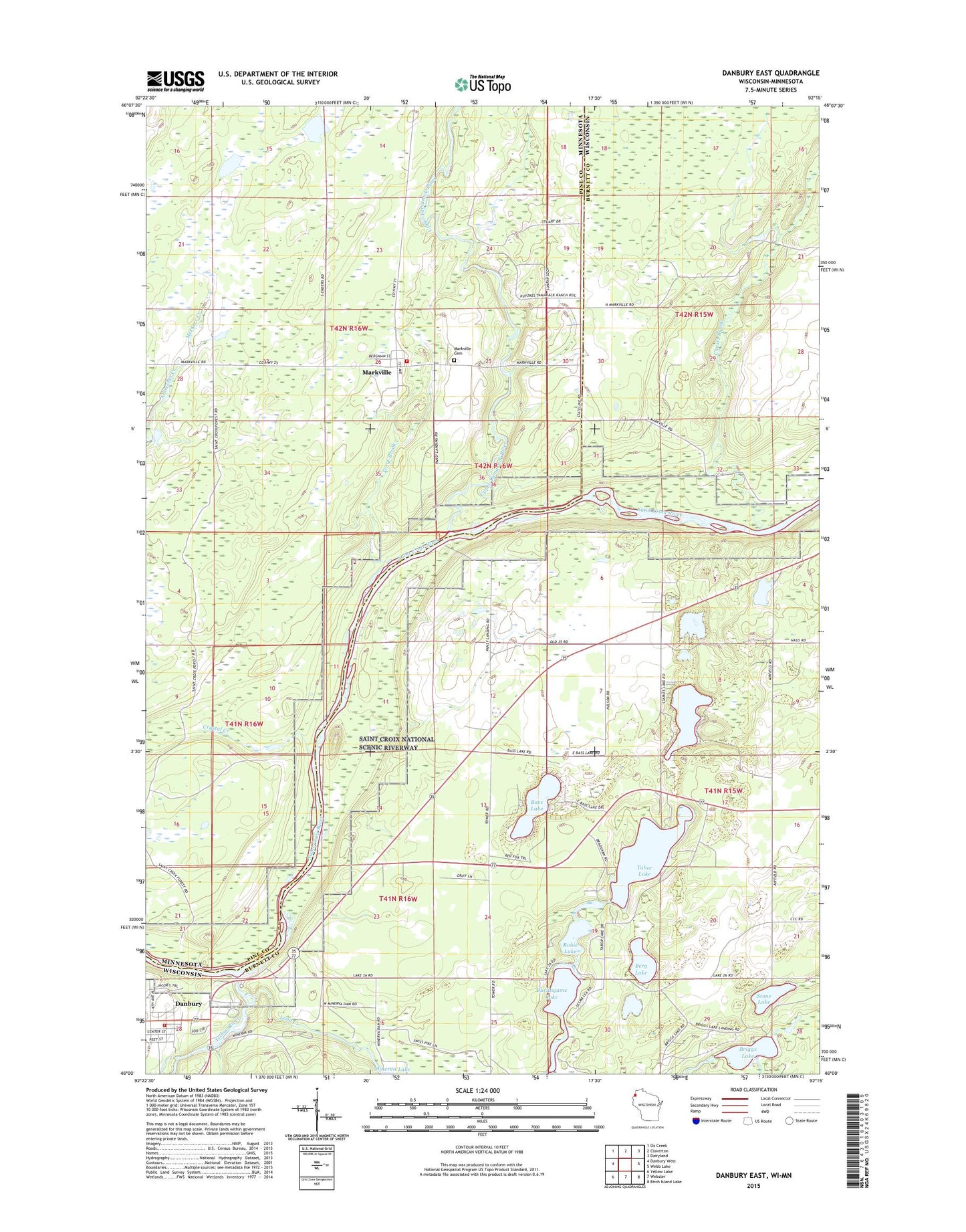
2019 topographic map quadrangle Danbury East in the states of Wisconsin, Minnesota. Scale: 1:24000. Based on the newly updated USGS 7.5' US Topo map series, this map is in the following counties: Burnett, Pine. The map contains contour data, water features, and other items you are used to seeing on USGS maps, but also has updated roads and other features. This is the next generation of topographic maps. Printed on high-quality waterproof paper with UV fade-resistant inks.
Quads adjacent to this one:
West: Danbury West
Northwest: Ox Creek
North: Cloverton
Northeast: Dairyland
East: Webb Lake
Southeast: Birch Island Lake
South: Webster
Southwest: Yellow Lake
Contains the following named places: Bass Lake, Berg Lake, Big Island State Natural Area, Briggs Lake, Burlingame Lake, Chases Brook, Crystal Creek, Danbury, Danbury Post Office, Danbury Volunteer Fire Department, Duxbury Fire Department Markville Station, Island Lake, Loon Creek, Markville, Markville Cemetery, Meekers Creek, Robie Lake, Staples Lake, Stone Lake, Tabor Lake, Town of Swiss, Township of Arna, Trout Brook, Upper Tamarack River, Yellow River