MyTopo
Webb Lake Wisconsin US Topo Map
Couldn't load pickup availability
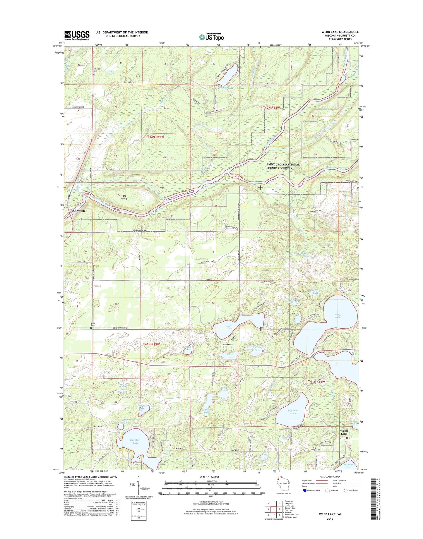
2022 topographic map quadrangle Webb Lake in the state of Wisconsin. Scale: 1:24000. Based on the newly updated USGS 7.5' US Topo map series, this map is in the following counties: Burnett. The map contains contour data, water features, and other items you are used to seeing on USGS maps, but also has updated roads and other features. This is the next generation of topographic maps. Printed on high-quality waterproof paper with UV fade-resistant inks.
Quads adjacent to this one:
West: Danbury East
Northwest: Cloverton
North: Dairyland
Northeast: Scovils Lake
East: Frog Lake
Southeast: McKenzie Lake
South: Birch Island Lake
Southwest: Webster
This map covers the same area as the classic USGS quad with code o46092a2.
Contains the following named places: Big Bear Lake, Big Island, Burnett County Camp, Clemens Creek, Deer Lake, Dogtown Creek, Dogtown Lake, Fawn Lake, Fenton Lake, Ferry Lake, Floyd Lake, Glendenning Creek, Greenwood Lake, Hay Creek, Hillcrest Cemetery Association, Johnson Lake, Little McGraw Lake, Little Round Lake, Luther Park Camp, McElroy Lake, Moore Farm Creek, Myrick Lake, Namekagon River, Nelson Creek, Perkins Creek, Riverside, Schaaf Lake, Swiss Cemetery, Thatcher Lake, Town of Blaine, Twentysix Lake, Webb Lake, Webb Lake Volunteer Fire and Rescue, ZIP Code: 54830