MyTopo
Yellow Lake Wisconsin US Topo Map
Couldn't load pickup availability
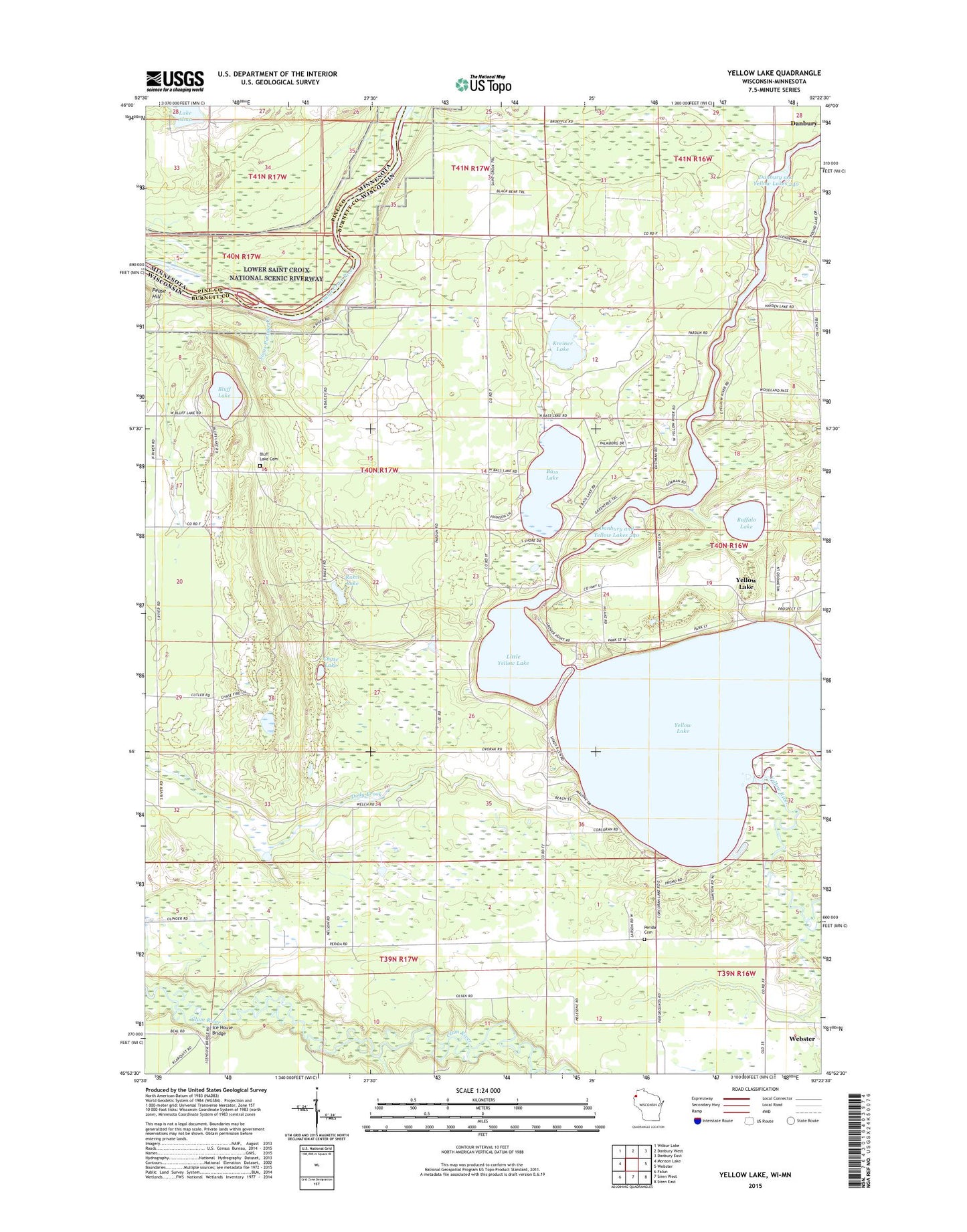
2022 topographic map quadrangle Yellow Lake in the states of Wisconsin, Minnesota. Scale: 1:24000. Based on the newly updated USGS 7.5' US Topo map series, this map is in the following counties: Burnett, Pine. The map contains contour data, water features, and other items you are used to seeing on USGS maps, but also has updated roads and other features. This is the next generation of topographic maps. Printed on high-quality waterproof paper with UV fade-resistant inks.
Quads adjacent to this one:
West: Monson Lake
Northwest: Wilbur Lake
North: Danbury West
Northeast: Danbury East
East: Webster
Southeast: Siren East
South: Siren West
Southwest: Falun
This map covers the same area as the classic USGS quad with code o45092h4.
Contains the following named places: Bass Lake, Black Brook, Bluff Lake, Bluff Lake Cemetery, Bluff Lake School, Buffalo Lake, Chase Lake, Danbury Dam, Danbury Flowage, Danbury Public Hunting Grounds, Ice House Bridge, Kreiner Lake, Lake Alma, Lincoln Townhall, Little Yellow Lake, Perida Cemetery, Perida School, Rahn Lake, Saint Johns Landing, Sioux Portage Campground, Sioux Portage Creek, Town of Union, Union Townhall, Yellow Lake