MyTopo
Diamond Bluff West Wisconsin US Topo Map
Couldn't load pickup availability
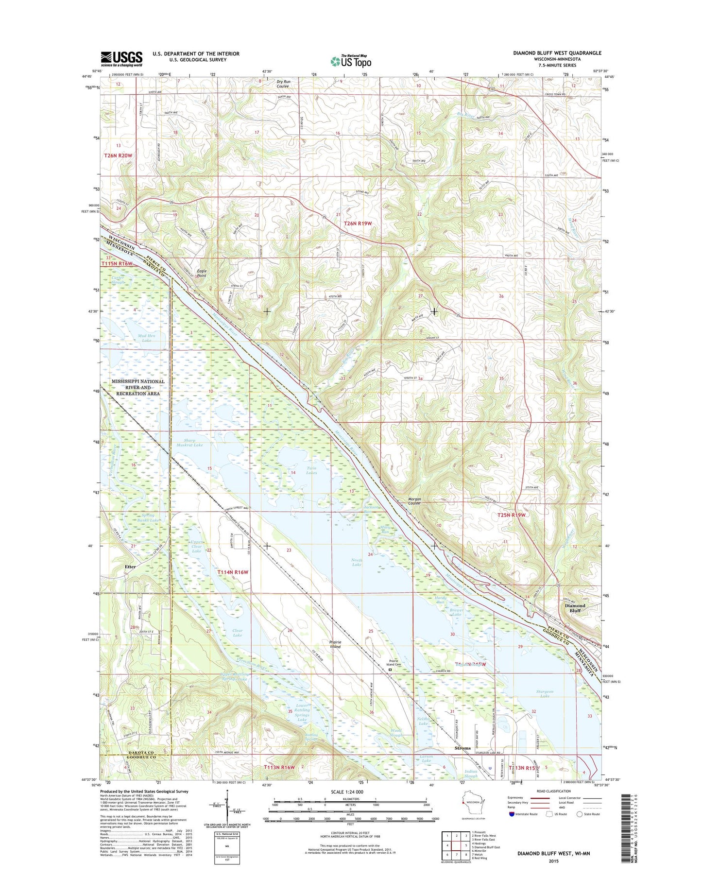
2018 topographic map quadrangle Diamond Bluff West in the states of Wisconsin, Minnesota. Scale: 1:24000. Based on the newly updated USGS 7.5' US Topo map series, this map is in the following counties: Pierce, Goodhue, Dakota. The map contains contour data, water features, and other items you are used to seeing on USGS maps, but also has updated roads and other features. This is the next generation of topographic maps. Printed on high-quality waterproof paper with UV fade-resistant inks.
Quads adjacent to this one:
West: Hastings
Northwest: Prescott
North: River Falls West
Northeast: River Falls East
East: Diamond Bluff East
Southeast: Red Wing
South: Welch
Southwest: Miesville
Contains the following named places: .20 Reservoir, 0.22 Reservoir, 54021, Big River, Brewer Lake, Buffalo Slough, Carter Slough, Clear Lake, Diamond Bluff, Eagle Point, Etter, Etter Post Office, Hardy Run, Huppert E 7689 Dam, Jackson Run, John G Hoikka G-9526 Dam, Larson Lake, Lower Rattling Springs Lake, Messiah Episcopal Church, Miley Run, Morgan Coulee, Mud Hen Lake, Nelson Lake, North Lake, Prairie Island, Prairie Island Cemetery, Prairie Island Indian Community, Prairie Island Tribal Police Department, Prairie Island-Schaller Airport, Rattling Springs, Saint Johns Church, Saint Marys School, Sharp Muskrat Lake, Smith Bar, Smith Landing, Spring Banks Lake, Stol Airport, Stroms, Sturgeon Lake, Town of Oak Grove, Twin Lakes, Upper Clear Lake, Upper Rattling Springs Lake, Wind River, Wood Slough