
MyTopo
Eureka Wisconsin US Topo Map
Couldn't load pickup availability
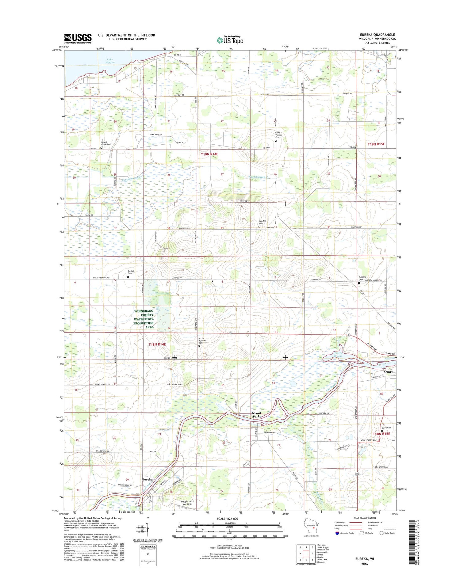
2018 topographic map quadrangle Eureka in the state of Wisconsin. Scale: 1:24000. Based on the newly updated USGS 7.5' US Topo map series, this map is in the following counties: Winnebago. The map contains contour data, water features, and other items you are used to seeing on USGS maps, but also has updated roads and other features. This is the next generation of topographic maps. Printed on high-quality waterproof paper with UV fade-resistant inks.
Quads adjacent to this one:
West: Auroraville
Northwest: Poy Sippi
North: Lake Poygan
Northeast: Oshkosh NW
East: Omro
Southeast: Pickett
South: Rush Lake
Southwest: Berlin
Contains the following named places: Burdick Cemetery, Cattleleana Ranch, Edinger Field, Enterprise Special Education School, Eureka, Eureka Census Designated Place, Forest Hill Cemetery, Foust Farms, Goggins Cemetery, Happy Jacks Air Strip, Hogers Bayou, Island Park, Kafer Farms, Knigge Farms, Liberty School, Methodist Church, North Rushford Cemetery, Oak Hill Cemetery, Omro Cemetery, Saint Thomas Aquinas Cemetery, Saint Thomas Church, Schuster Farm, Town of Poygan, Town of Rushford, Waukau Creek, Windy Hills Farm, ZIP Codes: 54934, 54963


