MyTopo
Lake Poygan Wisconsin US Topo Map
Couldn't load pickup availability
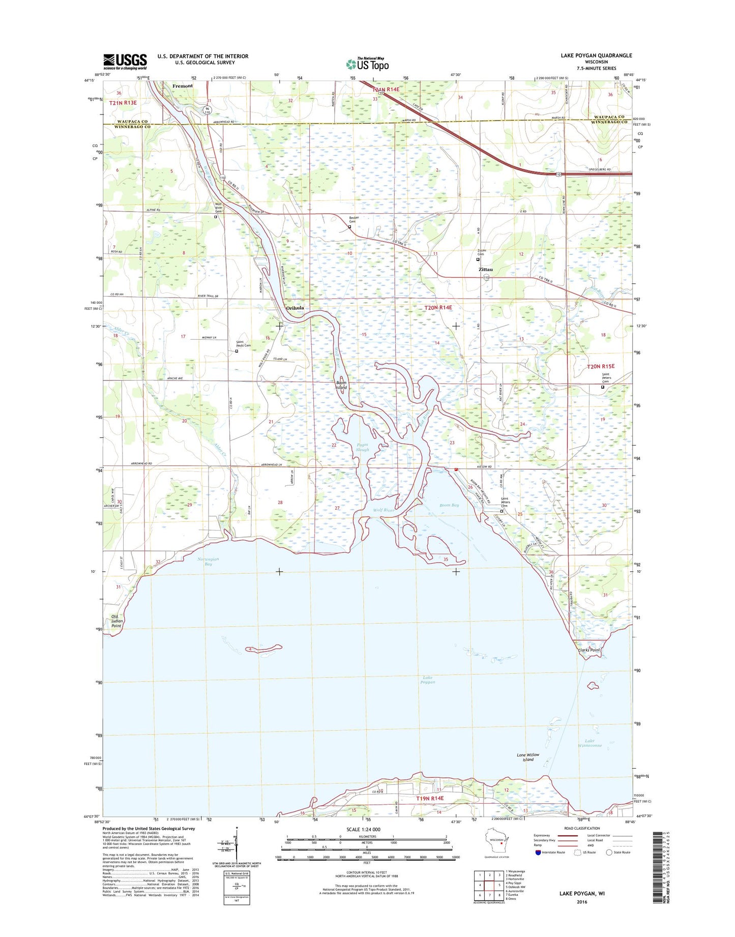
2022 topographic map quadrangle Lake Poygan in the state of Wisconsin. Scale: 1:24000. Based on the newly updated USGS 7.5' US Topo map series, this map is in the following counties: Winnebago, Waupaca. The map contains contour data, water features, and other items you are used to seeing on USGS maps, but also has updated roads and other features. This is the next generation of topographic maps. Printed on high-quality waterproof paper with UV fade-resistant inks.
Quads adjacent to this one:
West: Poy Sippi
Northwest: Weyauwega
North: Readfield
Northeast: Hortonville
East: Oshkosh NW
Southeast: Omro
South: Eureka
Southwest: Auroraville
This map covers the same area as the classic USGS quad with code o44088b7.
Contains the following named places: Alder Creek, Becker Cemetery, Boom Bay, Boom Island, Boombay Volunteer Fire Department, Clarks Point, Engelwood Farms, Hope Church, Immanuel Church, Lake Poygan, Lake View Cemetery, Lone Willow Island, Norwegian Bay, Old Indian Point, Orihula, Pages Slough, Poygan Lake, Rat River, Saint Pauls Cemetery, Saint Peters Church, Saint Peters Lutheran Cemetery, Town of Wolf River, Wolf River Cemetery, Wolf River School, Zion Church, Zittau, Zittau Cemetery, ZIP Code: 54940