MyTopo
Pickett Wisconsin US Topo Map
Couldn't load pickup availability
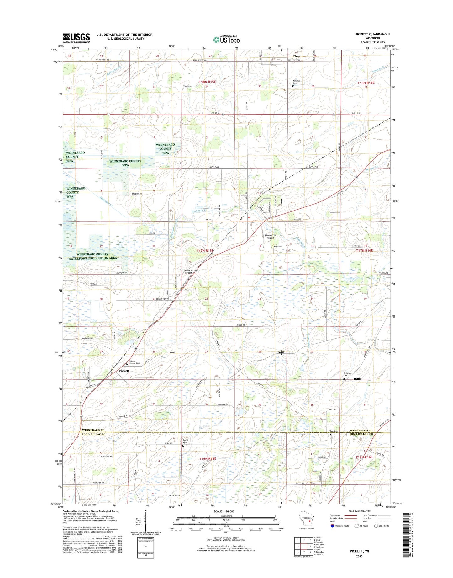
2022 topographic map quadrangle Pickett in the state of Wisconsin. Scale: 1:24000. Based on the newly updated USGS 7.5' US Topo map series, this map is in the following counties: Winnebago, Fond du Lac. The map contains contour data, water features, and other items you are used to seeing on USGS maps, but also has updated roads and other features. This is the next generation of topographic maps. Printed on high-quality waterproof paper with UV fade-resistant inks.
Quads adjacent to this one:
West: Rush Lake
Northwest: Eureka
North: Omro
Northeast: Oshkosh
East: Van Dyne
Southeast: Eldorado
South: Rosendale
Southwest: Ripon
This map covers the same area as the classic USGS quad with code o43088h6.
Contains the following named places: Bethesda Cemetery, Bradbo Farm, Bradley Farm, Buehring Farm, Davis Farms, Dencar Farms, Do - Da Dairy, Elo, Fisher Farms, Fisk, Fletcher School, Fritz Farm, Gizmo Farm, Hawley School, Hilltop Acres, Jackson School, Knott School, Liberty Prairie Cemetery, Maple Lane Farm, Maple School, Minckler Cemetery, Oak Grove School, Peace Cemetery, Peniel Church, Pfaffenroth Private Airport, Pickett, Pickett Post Office, Plainview School, Planeacres Airport, R and D Aqua Farm, Radloff Dairy Farm, Ring, Tice Cemetery, Tice School, Town of Utica, Triangle School, Utica Center School, Utica Volunteer Fire Department and First Responders, Williams Airport, Wind Ridge Farm, Zion, Zoar Cemetery, ZIP Code: 54964