MyTopo
Fahrney Point Wisconsin US Topo Map
Couldn't load pickup availability
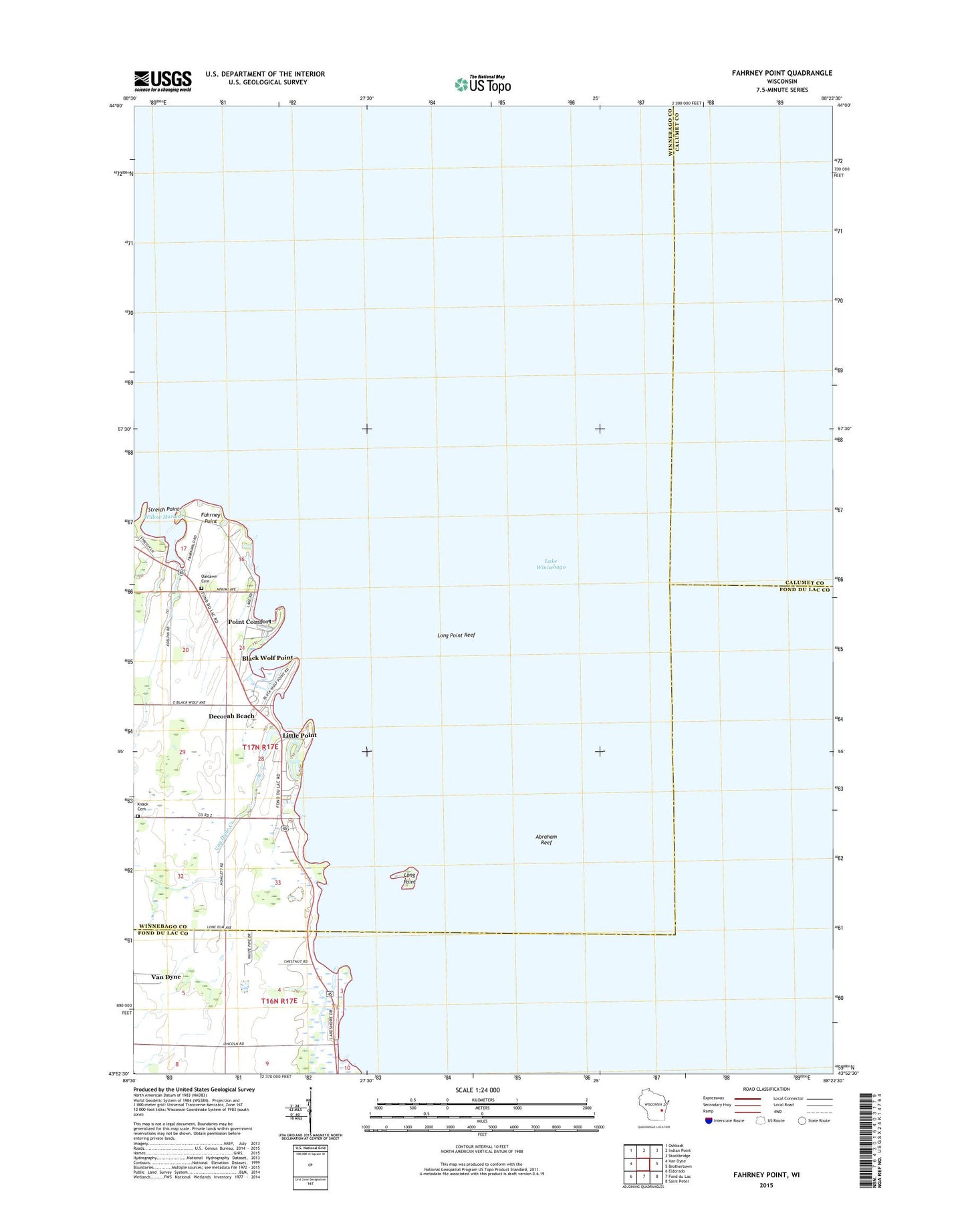
2018 topographic map quadrangle Fahrney Point in the state of Wisconsin. Scale: 1:24000. Based on the newly updated USGS 7.5' US Topo map series, this map is in the following counties: Winnebago, Fond du Lac, Calumet. The map contains contour data, water features, and other items you are used to seeing on USGS maps, but also has updated roads and other features. This is the next generation of topographic maps. Printed on high-quality waterproof paper with UV fade-resistant inks.
Quads adjacent to this one:
West: Van Dyne
Northwest: Oshkosh
North: Indian Point
Northeast: Stockbridge
East: Brothertown
Southeast: Saint Peter
South: Fond du Lac
Southwest: Eldorado
Contains the following named places: Abraham Reef, Air Harbor Seaplane Base, Black Wolf Farm, Black Wolf Point, Decorah Beach, Fahrney Point, Howlett School, Jesuit Retreat, Little Point, Long Point, Long Point Reef, Oaklawn Cemetery, Point Comfort, Streich Point, Town of Black Wolf, Van Dyne Creek, Willow Harbor, Zion Evangelical Lutheran Cemetery