MyTopo
Saint Peter Wisconsin US Topo Map
Couldn't load pickup availability
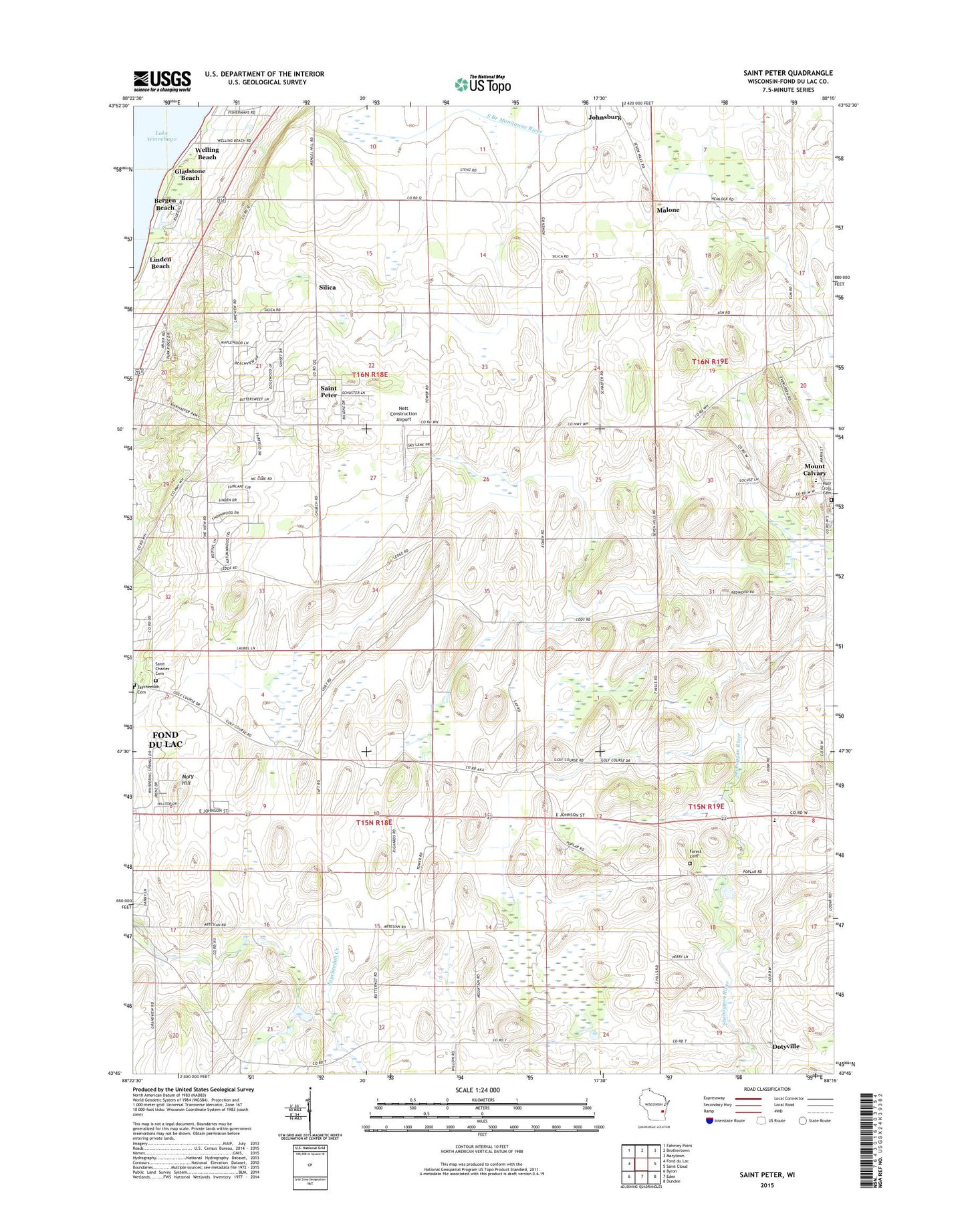
2022 topographic map quadrangle Saint Peter in the state of Wisconsin. Scale: 1:24000. Based on the newly updated USGS 7.5' US Topo map series, this map is in the following counties: Fond du Lac. The map contains contour data, water features, and other items you are used to seeing on USGS maps, but also has updated roads and other features. This is the next generation of topographic maps. Printed on high-quality waterproof paper with UV fade-resistant inks.
Quads adjacent to this one:
West: Fond du Lac
Northwest: Fahrney Point
North: Brothertown
Northeast: Marytown
East: Saint Cloud
Southeast: Dundee
South: Eden
Southwest: Byron
This map covers the same area as the classic USGS quad with code o43088g3.
Contains the following named places: Bergen Beach, Blaine School, Cherry Hill Orchard, Consolidated Parochial Elementary School, Dotyville, Edison School, Forest Cemetery, Freund Dairy Farm, Gladstone Beach, Holy Cross Cemetery, Linden Beach, Malone, Malone Post Office, Mary Hill, Nett Construction Airport, Saint Charles Cemetery, Saint Charles Chapel, Saint Pauls Lutheran School, Saint Peter, Saint Peter Census Designated Place, Silica, Taft School, Tay-Cal-Mar School, Taycheedah Cemetery, Town of Empire, Town of Taycheedah, Welling Beach, WFON-FM (Fond du Lac)