MyTopo
Indian Point Wisconsin US Topo Map
Couldn't load pickup availability
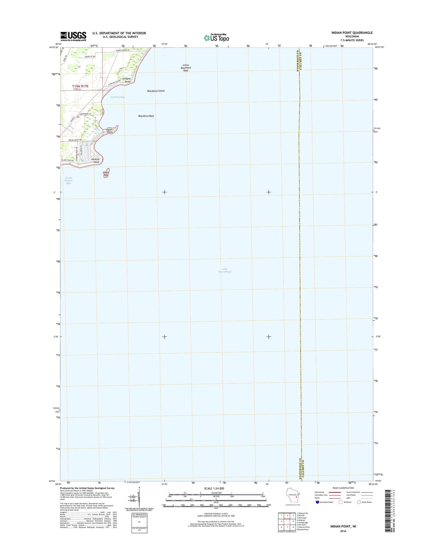
2022 topographic map quadrangle Indian Point in the state of Wisconsin. Scale: 1:24000. Based on the newly updated USGS 7.5' US Topo map series, this map is in the following counties: Winnebago, Calumet. The map contains contour data, water features, and other items you are used to seeing on USGS maps, but also has updated roads and other features. This is the next generation of topographic maps. Printed on high-quality waterproof paper with UV fade-resistant inks.
Quads adjacent to this one:
West: Oshkosh
Northwest: Oshkosh NE
North: Neenah
Northeast: Sherwood
East: Stockbridge
Southeast: Brothertown
South: Fahrney Point
Southwest: Van Dyne
This map covers the same area as the classic USGS quad with code o44088a4.
Contains the following named places: Blackbird Island, Blackbird Reef, Cowling Bay, Cowling School, Indian Point, Island Park, Jenkyns Point, Lake Winnebago, Little Blackbird Reef, Osh-O-Nee Midway Boat Ramp, Perkins Point, Town of Oshkosh, WRoe-FM (Neenah-Menasha)