MyTopo
Fairburn Wisconsin US Topo Map
Couldn't load pickup availability
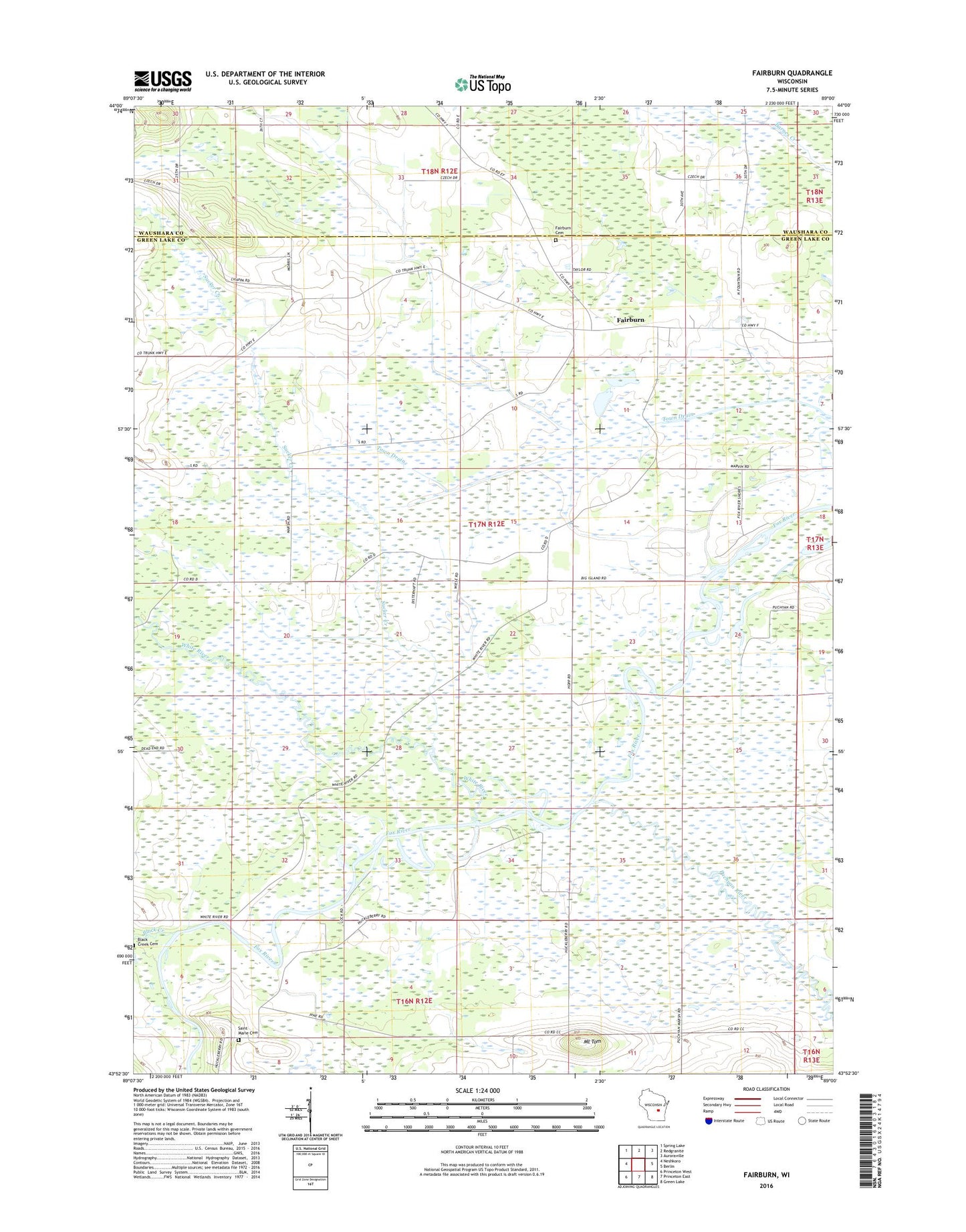
2018 topographic map quadrangle Fairburn in the state of Wisconsin. Scale: 1:24000. Based on the newly updated USGS 7.5' US Topo map series, this map is in the following counties: Green Lake, Waushara. The map contains contour data, water features, and other items you are used to seeing on USGS maps, but also has updated roads and other features. This is the next generation of topographic maps. Printed on high-quality waterproof paper with UV fade-resistant inks.
Quads adjacent to this one:
West: Neshkoro
Northwest: Spring Lake
North: Redgranite
Northeast: Auroraville
East: Berlin
Southeast: Green Lake
South: Princeton East
Southwest: Princeton West
Contains the following named places: Black Creek, Fairburn, Mount Tom, Princeton Prairie State Natural Area, Puchyan Prairie State Natural Area, Puchyan River, Saint Paul's Lutheran Cemetery, School Number 1, School Number 4, School Number 6, State Center Cemetery, Sucker Creek, Town of Saint Marie, Town of Seneca, White River, White River Lock, White River Marsh State Wildlife Area, White River Sedge Meadow State Natural Area