MyTopo
Princeton West Wisconsin US Topo Map
Couldn't load pickup availability
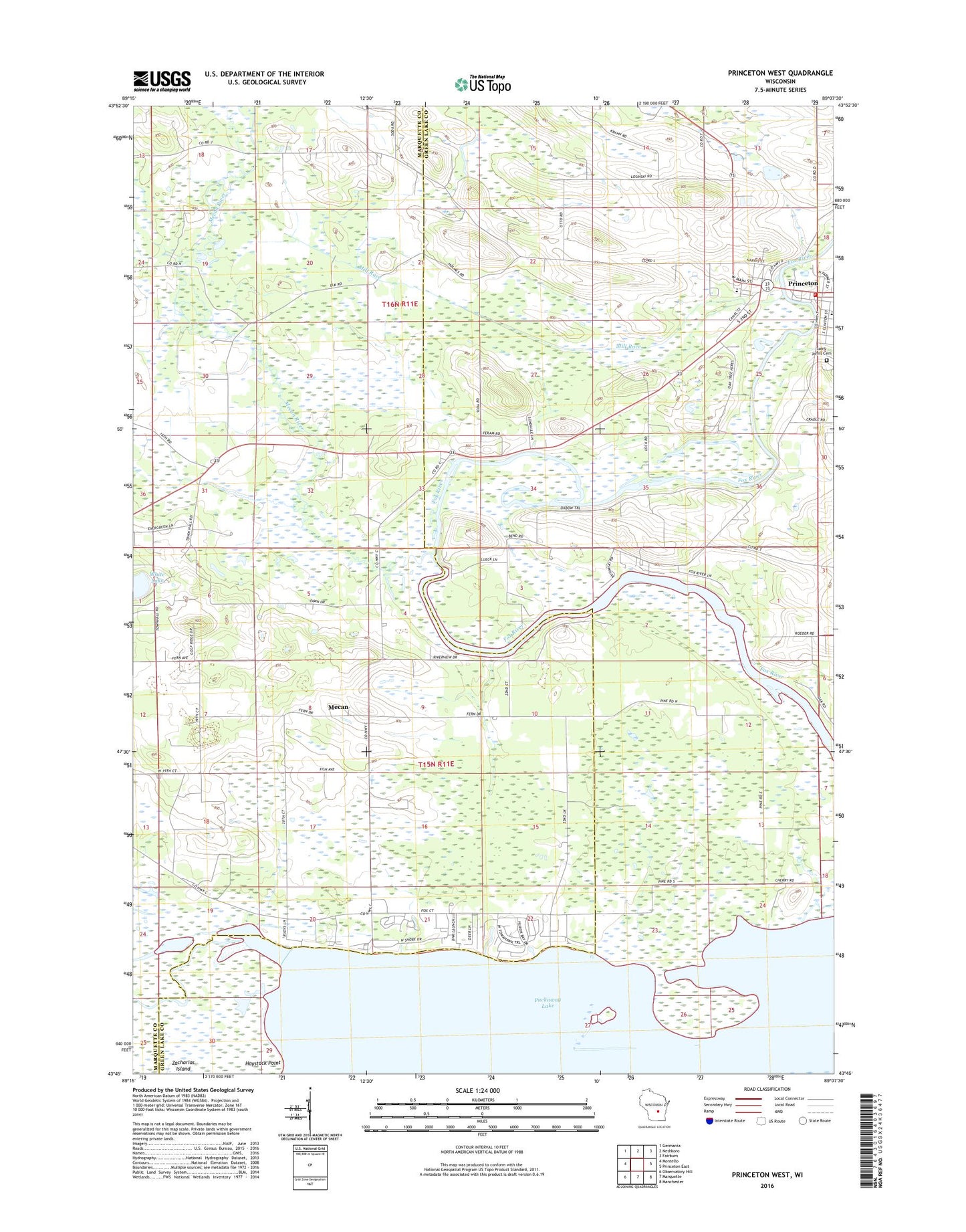
2022 topographic map quadrangle Princeton West in the state of Wisconsin. Scale: 1:24000. Based on the newly updated USGS 7.5' US Topo map series, this map is in the following counties: Green Lake, Marquette. The map contains contour data, water features, and other items you are used to seeing on USGS maps, but also has updated roads and other features. This is the next generation of topographic maps. Printed on high-quality waterproof paper with UV fade-resistant inks.
Quads adjacent to this one:
West: Montello
Northwest: Germania
North: Neshkoro
Northeast: Fairburn
East: Princeton East
Southeast: Manchester
South: Marquette
Southwest: Observatory Hill
This map covers the same area as the classic USGS quad with code o43089g2.
Contains the following named places: City of Princeton, Haystack Point, Immanuel Church, Mecan, Mecan River, Mill Race, Princeton Ambulance Service, Princeton Cemetery, Princeton Fire and Rescue Department, Princeton Lock, Princeton Post Office, Princeton Wastewater Treatment Plant, Puckaway Lake, Saint John the Baptist Catholic Church, Saint John the Baptist Catholic School, Saint Johns Catholic Cemetery, Saint Johns Lutheran Cemetery, Saint Johns Lutheran Church, Saint Johns Lutheran School, School Number 1, School Number 4, School Number 5, School Number 6, School Number 7, Town of Marquette, Town of Mecan, Trinity Church, ZIP Code: 54968