MyTopo
Neshkoro Wisconsin US Topo Map
Couldn't load pickup availability
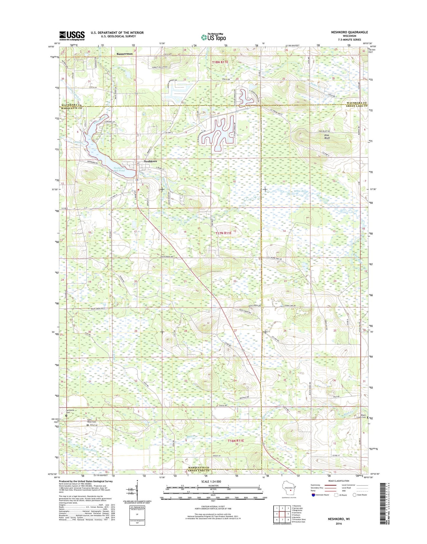
2022 topographic map quadrangle Neshkoro in the state of Wisconsin. Scale: 1:24000. Based on the newly updated USGS 7.5' US Topo map series, this map is in the following counties: Marquette, Green Lake, Waushara. The map contains contour data, water features, and other items you are used to seeing on USGS maps, but also has updated roads and other features. This is the next generation of topographic maps. Printed on high-quality waterproof paper with UV fade-resistant inks.
Quads adjacent to this one:
West: Germania
Northwest: Wautoma
North: Spring Lake
Northeast: Redgranite
East: Fairburn
Southeast: Princeton East
South: Princeton West
Southwest: Montello
This map covers the same area as the classic USGS quad with code o43089h2.
Contains the following named places: Bannerman, Bannerman Lake, Black Creek Cemetery, Germania Cemetery, Germania Lutheran Cemetery, Little Lunch Creek, Lunch Creek, Neshkoro, Neshkoro Area Fire Protection District, Neshkoro Dam, Neshkoro Elementary School, Neshkoro Mill Pond, Neshkoro Police Department, Neshkoro Post Office, Neshkoro Village Cemetery, Pine Bluff, Rabbit School, Rodney, School Number 1, School Number 2, School Number 4, School Number 7, School Number 8, School Number 9, Town of Neshkoro, Village of Neshkoro, White River Prairie-Tamaracks State Natural Area, Zion Evangelical Lutheran Cemetery, ZIP Code: 54960