MyTopo
Five Corners Wisconsin US Topo Map
Couldn't load pickup availability
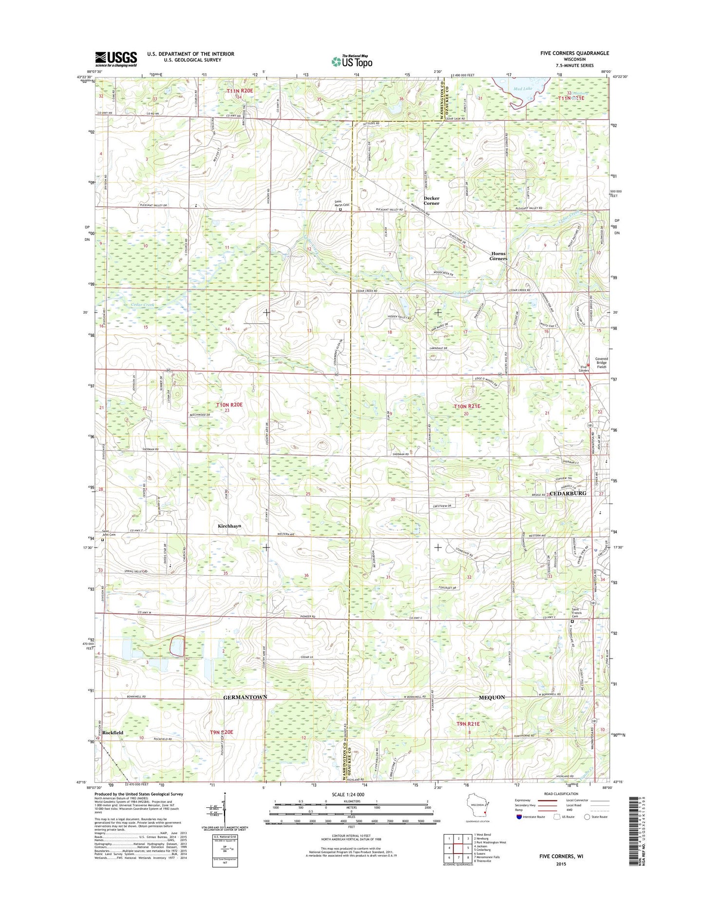
2022 topographic map quadrangle Five Corners in the state of Wisconsin. Scale: 1:24000. Based on the newly updated USGS 7.5' US Topo map series, this map is in the following counties: Washington, Ozaukee. The map contains contour data, water features, and other items you are used to seeing on USGS maps, but also has updated roads and other features. This is the next generation of topographic maps. Printed on high-quality waterproof paper with UV fade-resistant inks.
Quads adjacent to this one:
West: Jackson
Northwest: West Bend
North: Newburg
Northeast: Port Washington West
East: Cedarburg
Southeast: Thiensville
South: Menomonee Falls
Southwest: Sussex
This map covers the same area as the classic USGS quad with code o43088c1.
Contains the following named places: Bell Grove School, Bonniwell School, Cedar Lynn Farm, Cedarburg Police Department, Cedarburg Town Hall, Cedarburg Volunteer Fire Department Station 2, Covered Bridge Park, David Star Church, Davids Star Lutheran School, Decker Corner, Elm Tree School, Five Corners, Frenz Orchards, Hawthorn Lake, Hidden Talent Farm, Horns Corners, Jackson Marsh State Natural Area, Jackson Marsh State Wildlife Area, Kirchhayn, Mud Lake, Niemann Orchards, Parkview Elementary School, Saint Francis Cemetery, Saint John Cemetery, Saint Marys Cemetery, Sherman School, Soulth Center School, Town of Cedarburg, Town of Jackson, Trinity Lutheran School, Webster Transitional School, ZIP Code: 53012