MyTopo
Forestville Wisconsin US Topo Map
Couldn't load pickup availability
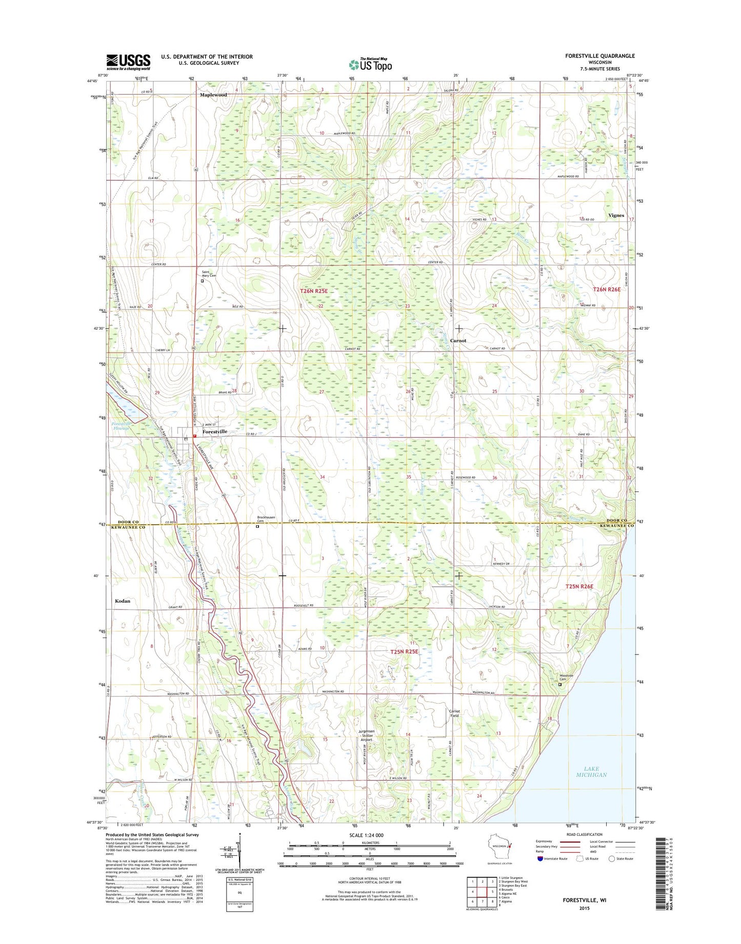
2018 topographic map quadrangle Forestville in the state of Wisconsin. Scale: 1:24000. Based on the newly updated USGS 7.5' US Topo map series, this map is in the following counties: Door, Kewaunee. The map contains contour data, water features, and other items you are used to seeing on USGS maps, but also has updated roads and other features. This is the next generation of topographic maps. Printed on high-quality waterproof paper with UV fade-resistant inks.
Quads adjacent to this one:
West: Brussels
Northwest: Little Sturgeon
North: Sturgeon Bay West
Northeast: Sturgeon Bay East
East: Algoma NE
South: Algoma
Southwest: Casco
Contains the following named places: Brockhausen Cemetery, Carnot, Carnot Field, Cherry Lane Orchards, Clark Farms, Door County Library Forestville Branch, Door County Park, Door Quarry South, East Maplewood School, Forest Chapel, Forestville, Forestville 1885C70 Dam, Forestville Post Office, Forestville Wastewater Treatment Plant, Foscoro Airport, Gigstad Farms, Harmann Farms, Jorgensen - Stoller Airport, Kirchman Farms, Kodan, Kodan School, Krause G5896 1 Dam, Lakeview School, Maplewood, Mathison Farms, Olson Farm, Peninsula Dairy, Saint Mary Cemetery, Saint Marys Church, Silver Creek, Southern Door Volunteer Fire Department, Steiner Farm, Stony Creek, Stony Creek Vineyards, Tanum Church, Town of Ahnapee, Town of Forestville, Vignes, Village of Forestville, Vistren Farms, Woodside Cemetery, Woodside School