MyTopo
Little Sturgeon Wisconsin US Topo Map
Couldn't load pickup availability
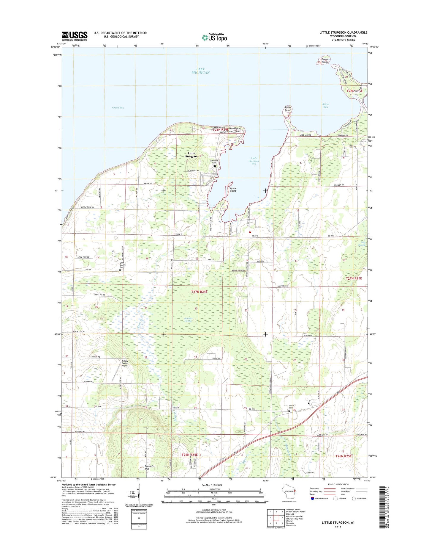
2023 topographic map quadrangle Little Sturgeon in the state of Wisconsin. Scale: 1:24000. Based on the newly updated USGS 7.5' US Topo map series, this map is in the following counties: Door. The map contains contour data, water features, and other items you are used to seeing on USGS maps, but also has updated roads and other features. This is the next generation of topographic maps. Printed on high-quality waterproof paper with UV fade-resistant inks.
Quads adjacent to this one:
West: Little Sturgeon SW
Northwest: Peshtigo Harbor
Northeast: Idlewild
East: Sturgeon Bay West
Southeast: Forestville
South: Brussels
Southwest: Namur
This map covers the same area as the classic USGS quad with code o44087g5.
Contains the following named places: Brussels - Union - Gardner Fire Department Station 2, Brussels Hill, Claflin County Park, Crispy Cedars Airport, Episcopal Church, Four Corners School, Gardner School, Gardner Swamp, Gardner Swamp State Wildlife Area, Geise Cemetery, Henderson Point, Keyes Creek, Little Sturgeon, Little Sturgeon Bay, Little Sturgeon Census Designated Place, Malvitz Bay Farms, Pleasant View School, Rileys Bay, Rileys Point, Saint Joseph Cemetery, Silver Creek, Snake Island, Southern Door Elementary School, Southern Door High School, Southern Door Middle School, Southren Door High School, Squaw Island, Stevenson Cemetery, Stevenson Pier School, Tornado Memorial County Park, Tornado School, Town of Gardner, Wautier Farm, White Star Church, Willems Mobile Home Park, ZIP Code: 54204