MyTopo
Fort Atkinson Wisconsin US Topo Map
Couldn't load pickup availability
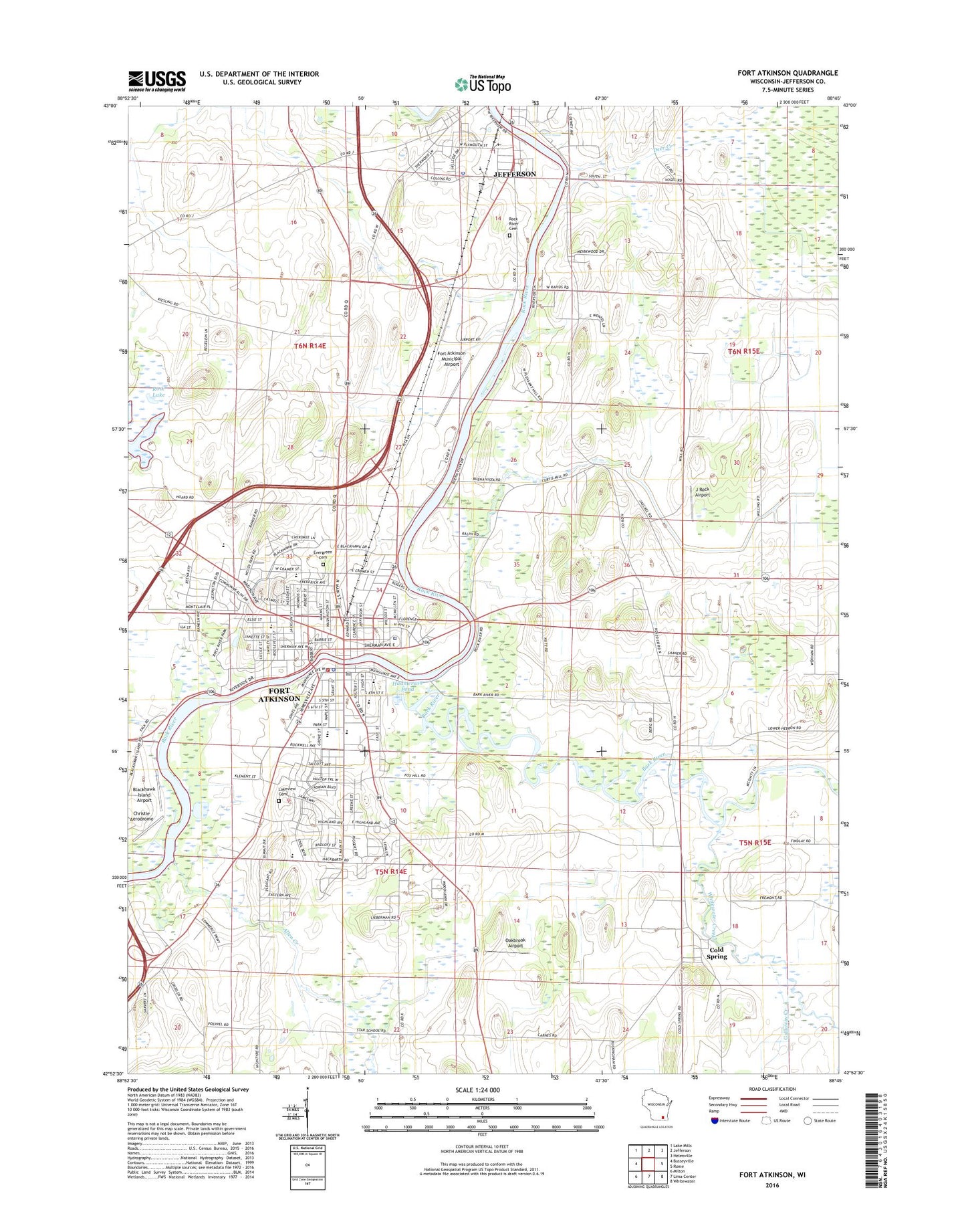
2018 topographic map quadrangle Fort Atkinson in the state of Wisconsin. Scale: 1:24000. Based on the newly updated USGS 7.5' US Topo map series, this map is in the following counties: Jefferson. The map contains contour data, water features, and other items you are used to seeing on USGS maps, but also has updated roads and other features. This is the next generation of topographic maps. Printed on high-quality waterproof paper with UV fade-resistant inks.
Quads adjacent to this one:
West: Busseyville
Northwest: Lake Mills
North: Jefferson
Northeast: Helenville
East: Rome
Southeast: Whitewater
South: Lima Center
Southwest: Milton
Contains the following named places: Allen Creek, Bark River, Bark River Park, Barrie Elementary School, Barrie Park, Bethany Evangelical Lutheran Church, Bicentennial Park, Blackhawk Island Airport, Christie Aerodrome, City of Fort Atkinson, Cold Spring, Cold Spring Union Cemetery, Countryside Home and Hospital, Deer Creek, Dwight Foster Public Library, Endl Park, Evergreen Cemetery, Faith Community Christian School, Faith Community Church, First Baptist Church, First Church of Christ Scientist, First Congregational United Church of Christ, First United Methodist Church, Fort Atkinson, Fort Atkinson 4K School, Fort Atkinson Fire Department, Fort Atkinson Health Care Center, Fort Atkinson High School, Fort Atkinson Memorial Hospital Heliport, Fort Atkinson Middle School, Fort Atkinson Municipal Airport, Fort Atkinson Police Department, Fort Atkinson Post Office, Fort Atkinson Wastewater Treatment Facility, Fort Koshkonong, Fort Memorial Hospital, Fort Quarry, Friedens United Church of Christ, Friendship Baptist Church, Full Gospel Church, Galloway Creek, Happy Time Nursery School, Haumerson Pond, Hoard Historical Museum, J Rock Airport, Jedi Virtual High School, Jefferson County Potter's Field Cemetery, Jefferson Police Department, Jones Park, Kingdom Hall of Jehovahs Witnesses, Kutz Dairy, Lakeview Cemetery, Luther Elementary School, Madison Area Technical College - Fort Atkinson, McCoy Park, Meadow Springs Golf Course, Memorial Park, Oakbrook Airport, Painther Intaglio, Peace Lutheran Church, Purdy Elementary School, Ralph Park, Rock River Cemetery, Rock River Park, Rockwell Elementary School, Rose Lake, Ryan Brothers Ambulance Fort Atkinson Station, Saint Joseph Catholic School, Saint Joseph Grade School, Saint Josephs Catholic Church, Saint Pauls Evangelical Lutheran Church, Saint Pauls Lutheran School, Saint Peters Episcopal Church, South Industrial Park, Tensfeldt Park, Town of Jefferson, Town of Koshkonong, Trinity Lutheran Church, WFAW-AM (Fort Atkinson), Whitewater Creek, ZIP Codes: 53538, 53549