MyTopo
Rome Wisconsin US Topo Map
Couldn't load pickup availability
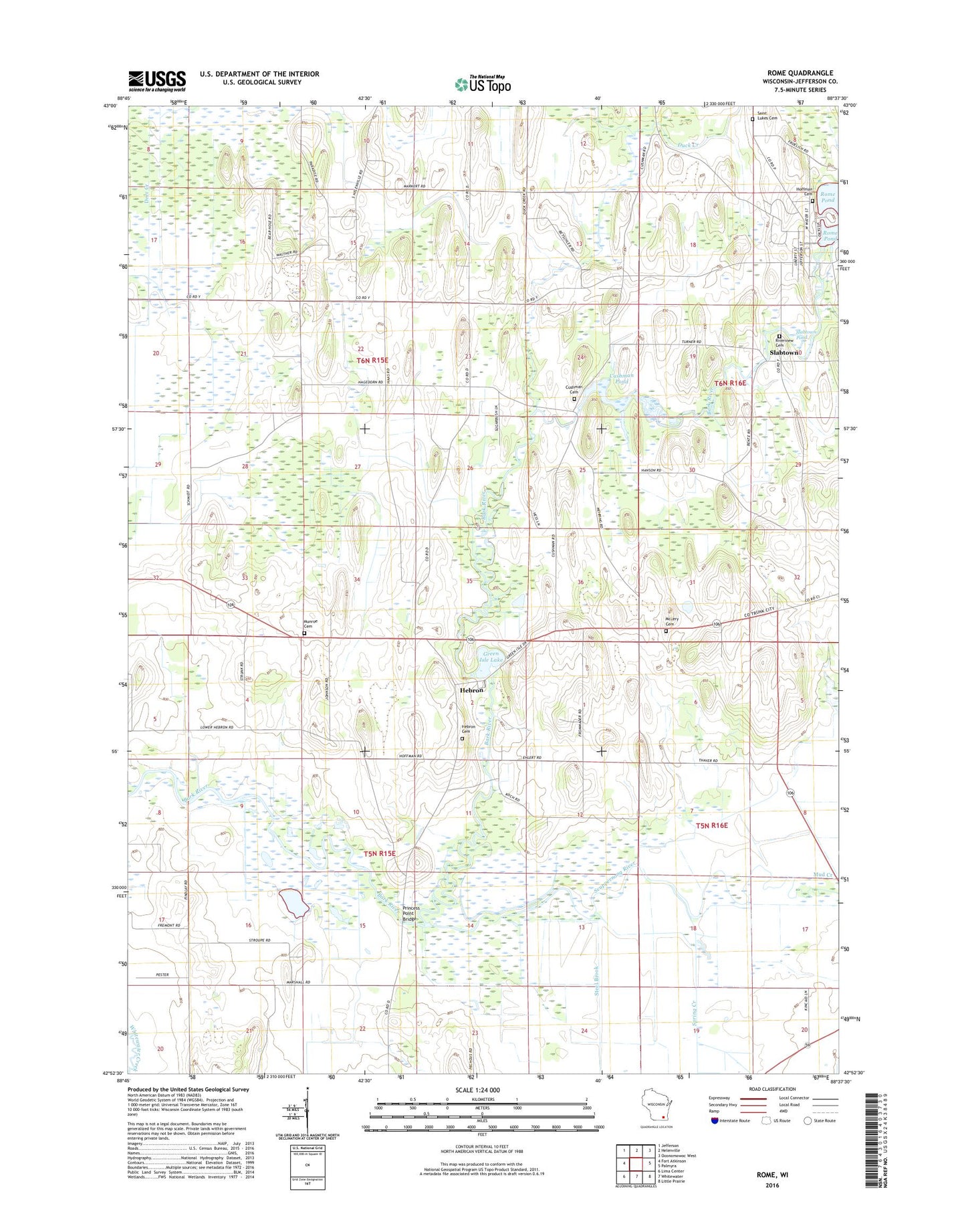
2022 topographic map quadrangle Rome in the state of Wisconsin. Scale: 1:24000. Based on the newly updated USGS 7.5' US Topo map series, this map is in the following counties: Jefferson. The map contains contour data, water features, and other items you are used to seeing on USGS maps, but also has updated roads and other features. This is the next generation of topographic maps. Printed on high-quality waterproof paper with UV fade-resistant inks.
Quads adjacent to this one:
West: Fort Atkinson
Northwest: Jefferson
North: Helenville
Northeast: Oconomowoc West
East: Palmyra
Southeast: Little Prairie
South: Whitewater
Southwest: Lima Center
This map covers the same area as the classic USGS quad with code o42088h6.
Contains the following named places: Cedar Ridge Farm, Crowder Cemetery, Cushman Cemetery, Cushman Dam, Cushman Lake 122, Cushman Mill School, Cushman Pond, Duck Creek, Green Isle Lake, Hebron, Hebron 2WP441 Dam, Hebron Cemetery, Hebron Census Designated Place, Hickory Oaks Farm, Hoffman Cemetery, Maple Run Farm, McLery Cemetery, Monroe Cemetery, Mud Creek, Princes Point WLA Number 1 H2.117 Dam, Princes Point WLA Number 2 H2.117 Dam, Princess Point Bridge, Riverview Cemetery, Rome, Rome 3WR1668 Dam, Rome Census Designated Place, Rome Fire Department, Royal Betschler Farms, Saint Luke's Cemetery, Schelm Farms, Scuppernong River, Slabtown, Slabtown Pond, Spring Creek, Steel Brook, Town of Cold Spring, Town of Hebron