MyTopo
Helenville Wisconsin US Topo Map
Couldn't load pickup availability
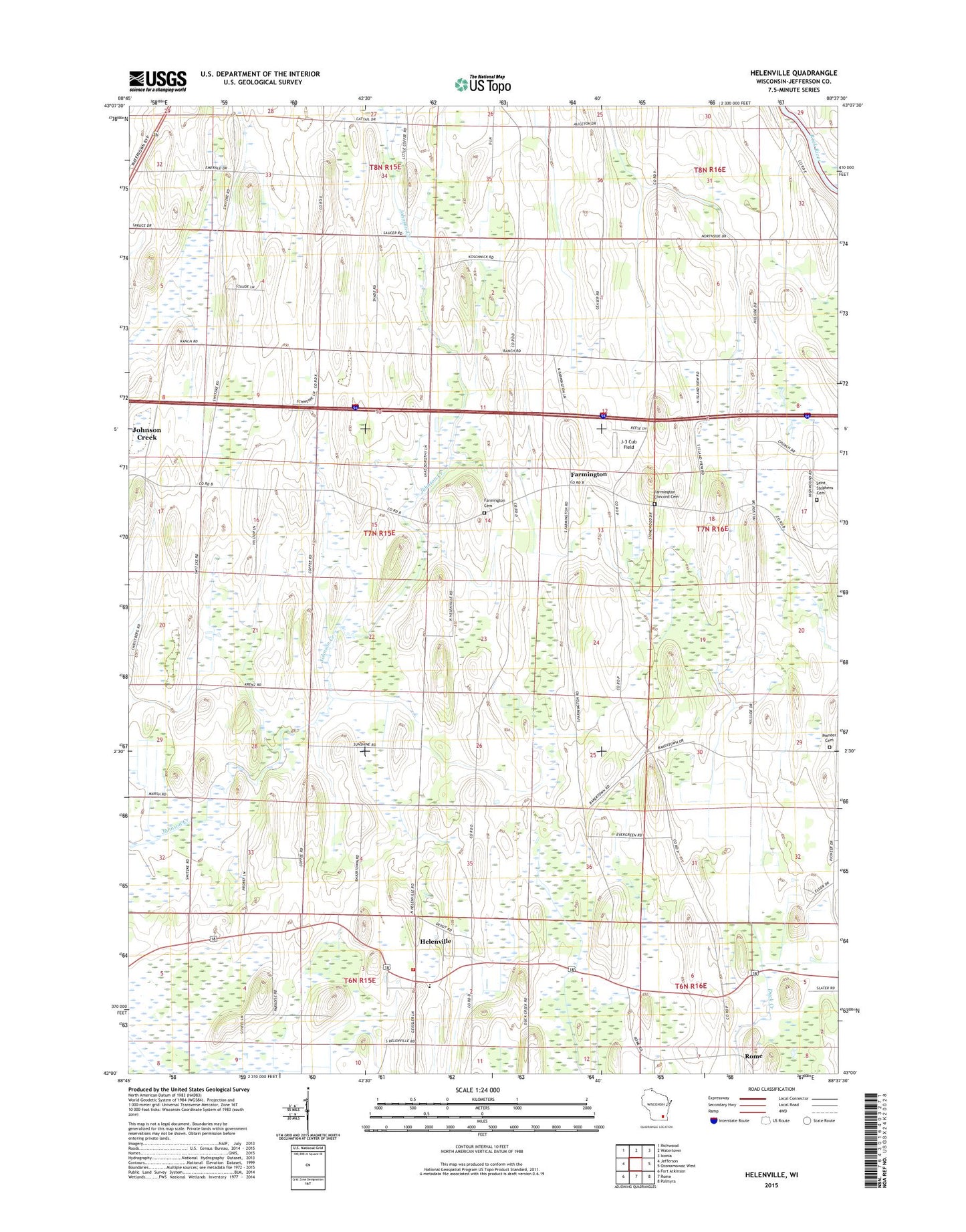
2022 topographic map quadrangle Helenville in the state of Wisconsin. Scale: 1:24000. Based on the newly updated USGS 7.5' US Topo map series, this map is in the following counties: Jefferson. The map contains contour data, water features, and other items you are used to seeing on USGS maps, but also has updated roads and other features. This is the next generation of topographic maps. Printed on high-quality waterproof paper with UV fade-resistant inks.
Quads adjacent to this one:
West: Jefferson
Northwest: Richwood
North: Watertown
Northeast: Ixonia
East: Oconomowoc West
Southeast: Palmyra
South: Rome
Southwest: Fort Atkinson
This map covers the same area as the classic USGS quad with code o43088a6.
Contains the following named places: Baker Town School, Bakertown Baptist Cemetery, Deer Track Park Landfill, Evergreen Cemetery, Farmington, Farmington Cemetery, Farmington Concord Cemetery, Helenville, Helenville Census Designated Place, Helenville Post Office, Helenville Volunteer Fire Department, High Lawn School, Immanuel Church, Immanuel Lutheran Cemetery, J-3 Cub Field, Maple Mound Farm, Maple View School, Palm Mushroom Cellars, Pioneer Cemetery, Probst Farm, Saint Peters Lutheran School, Saint Stephens Cemetery, Saint Stephens Lutheran Church, Saint Stephens School, Sunshine School, Town of Farmington, Woodside School, ZIP Code: 53137