MyTopo
Fromm Lookout Tower Wisconsin US Topo Map
Couldn't load pickup availability
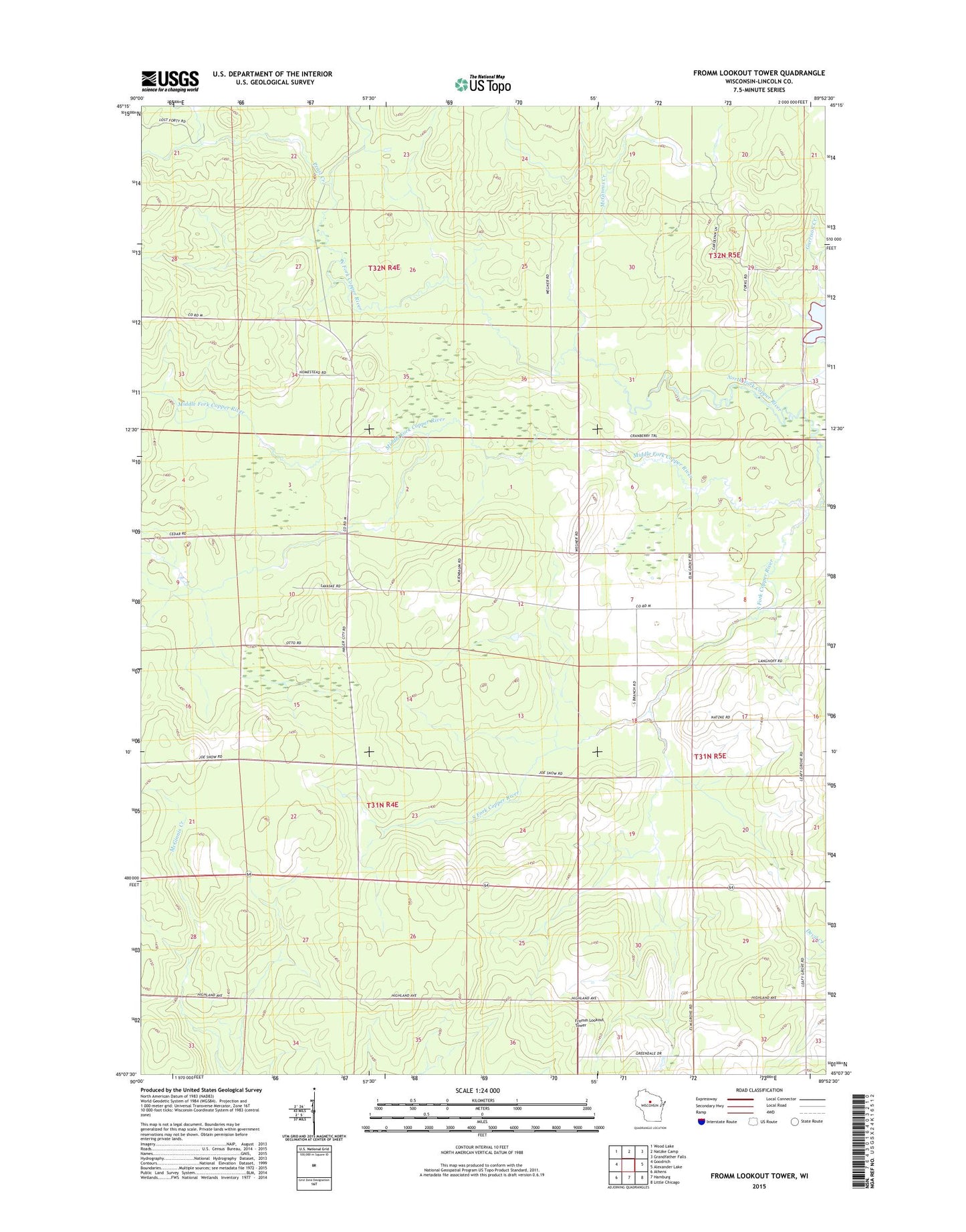
2018 topographic map quadrangle Fromm Lookout Tower in the state of Wisconsin. Scale: 1:24000. Based on the newly updated USGS 7.5' US Topo map series, this map is in the following counties: Lincoln. The map contains contour data, water features, and other items you are used to seeing on USGS maps, but also has updated roads and other features. This is the next generation of topographic maps. Printed on high-quality waterproof paper with UV fade-resistant inks.
Quads adjacent to this one:
West: Goodrich
Northwest: Wood Lake
North: Natzke Camp
Northeast: Grandfather Falls
East: Alexander Lake
Southeast: Little Chicago
South: Hamburg
Southwest: Athens
Contains the following named places: Camp 19, Emmanuel School, Fromm Lookout Tower, Green Dale School, Immanuel Church, Leafy Grove School, McGinnis Creek, Middle Fork Copper River, North Fork Copper River, Prast Creek, South Fork Copper River, Town of Corning