MyTopo
Grandfather Falls Wisconsin US Topo Map
Couldn't load pickup availability
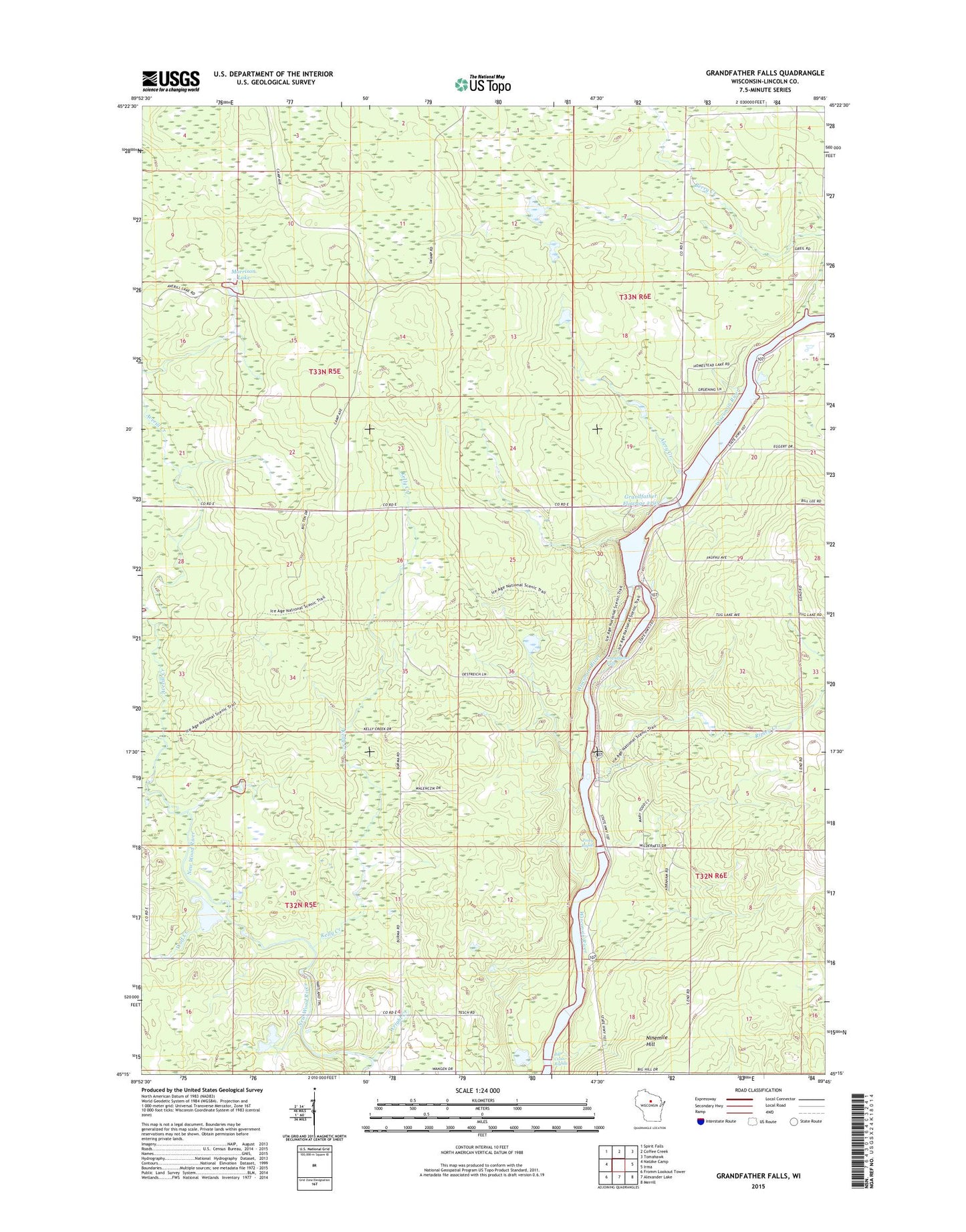
2022 topographic map quadrangle Grandfather Falls in the state of Wisconsin. Scale: 1:24000. Based on the newly updated USGS 7.5' US Topo map series, this map is in the following counties: Lincoln. The map contains contour data, water features, and other items you are used to seeing on USGS maps, but also has updated roads and other features. This is the next generation of topographic maps. Printed on high-quality waterproof paper with UV fade-resistant inks.
Quads adjacent to this one:
West: Natzke Camp
Northwest: Spirit Falls
North: Coffee Creek
Northeast: Tomahawk
East: Irma
Southeast: Merrill
South: Alexander Lake
Southwest: Fromm Lookout Tower
This map covers the same area as the classic USGS quad with code o45089c7.
Contains the following named places: Alery Creek, Averill Creek, Berry Creek, Bill Cross Rapids, Camp New Wood County Park, Grandfather Dam, Grandfather Falls, Grandfather Flowage 2295, Grandmother School, Kelly Creek, Morrison Lake, New Wood School, Posey Rapids, Ripley Creek, Town of Harding, Upper Grandfather Falls 2WP357 Dam, Wolf Creek, Wright Creek