MyTopo
Goodrich Wisconsin US Topo Map
Couldn't load pickup availability
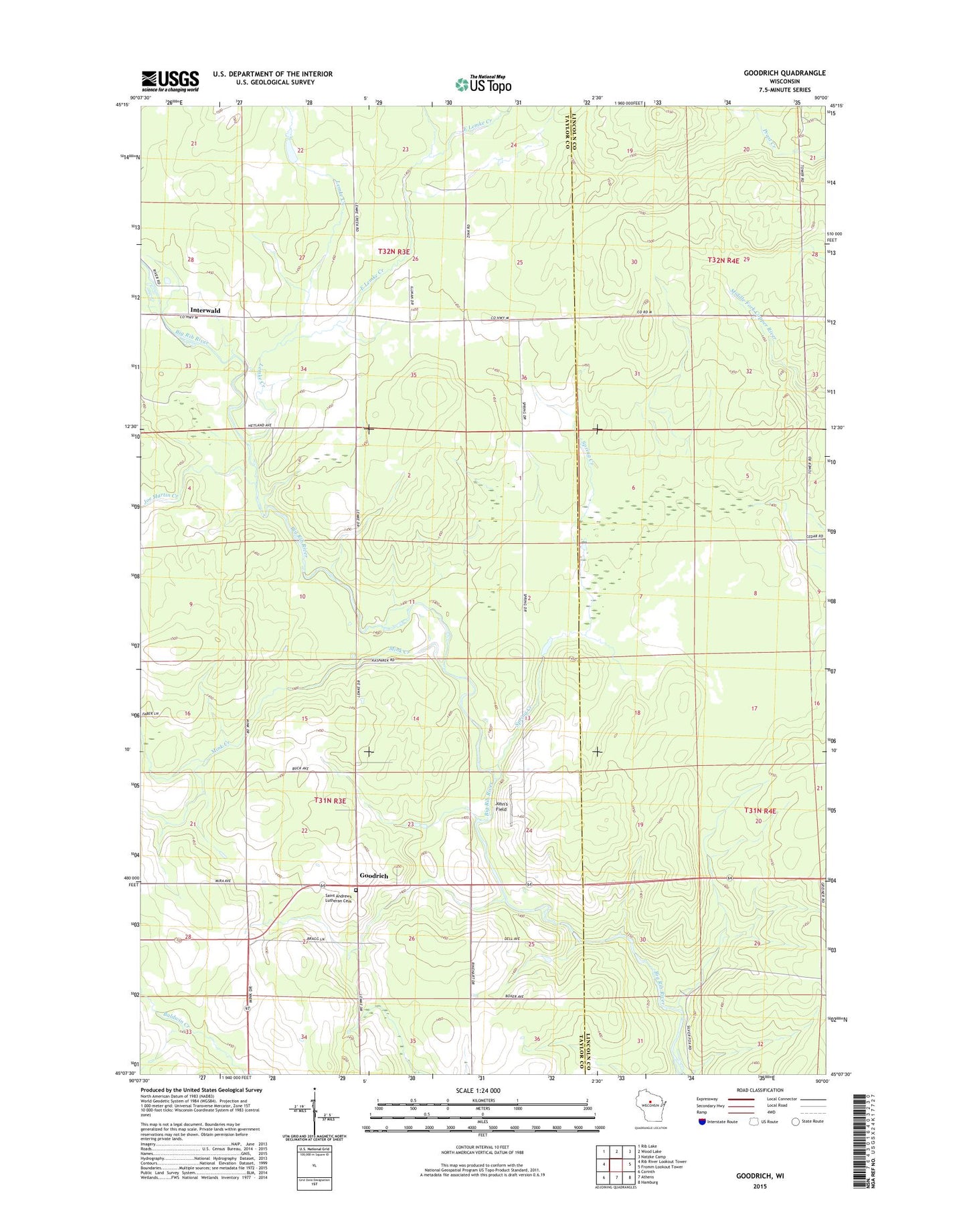
2022 topographic map quadrangle Goodrich in the state of Wisconsin. Scale: 1:24000. Based on the newly updated USGS 7.5' US Topo map series, this map is in the following counties: Taylor, Lincoln. The map contains contour data, water features, and other items you are used to seeing on USGS maps, but also has updated roads and other features. This is the next generation of topographic maps. Printed on high-quality waterproof paper with UV fade-resistant inks.
Quads adjacent to this one:
West: Rib River Lookout Tower
Northwest: Rib Lake
North: Wood Lake
Northeast: Natzke Camp
East: Fromm Lookout Tower
Southeast: Hamburg
South: Athens
Southwest: Corinth
This map covers the same area as the classic USGS quad with code o45090b1.
Contains the following named places: East Lemke Creek, Goodrich, Goodrich Church, Goodrich Townhall, Green Grove 4-H Park, Green Meadow School, Interwald, Joe Martin Creek, John's Field, Lemke Creek, Mink Creek, Saint Andrews Evangelical Lutheran Parish Cemetery, Spring Creek, Town of Goodrich