MyTopo
George Lake Wisconsin US Topo Map
Couldn't load pickup availability
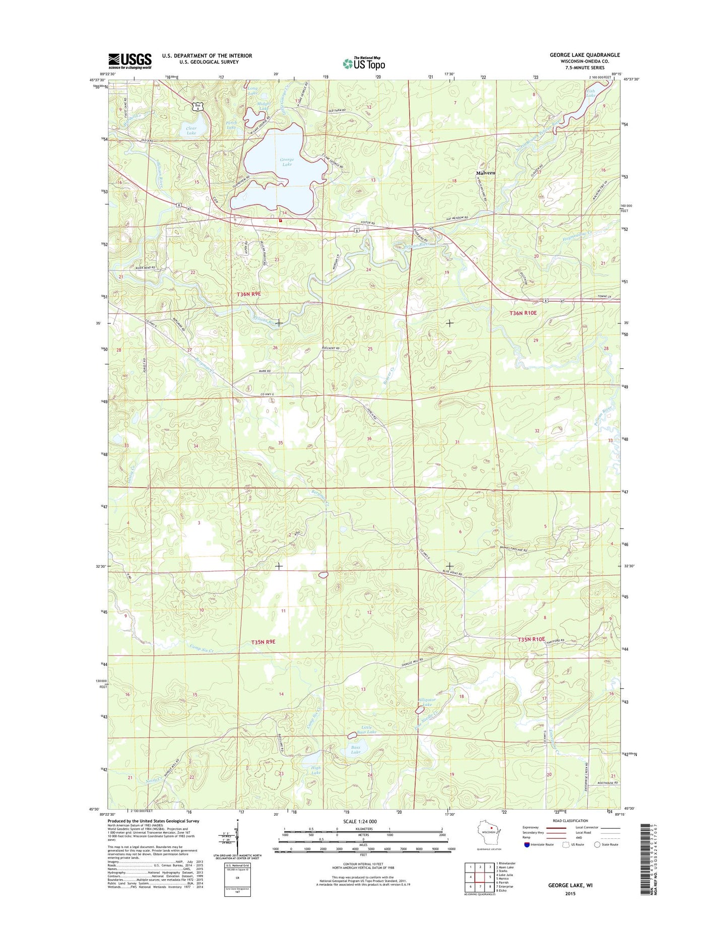
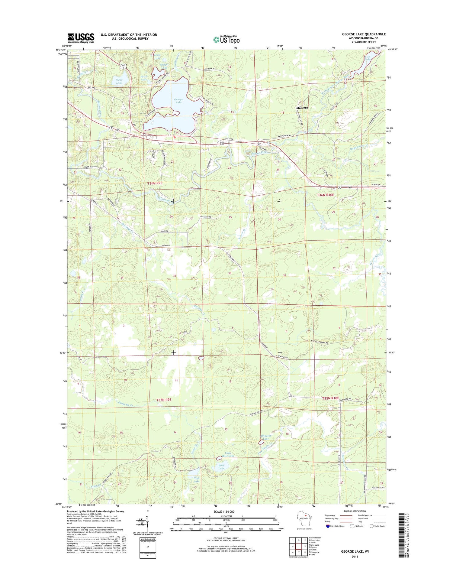
2018 topographic map quadrangle George Lake in the state of Wisconsin. Scale: 1:24000. Based on the newly updated USGS 7.5' US Topo map series, this map is in the following counties: Oneida. The map contains contour data, water features, and other items you are used to seeing on USGS maps, but also has updated roads and other features. This is the next generation of topographic maps. Printed on high-quality waterproof paper with UV fade-resistant inks.
Quads adjacent to this one:
West: Lake Julia
Northwest: Rhinelander
North: Moen Lake
Northeast: Starks
East: Monico
Southeast: Elcho
South: Enterprise
Southwest: Parrish
Contains the following named places: Alligator Lake, Bass Lake, Beaver Creek, Bergman Creek, Clear Lake, Cuenin Creek, Enterprise Recreation Area, Fish Lake, George Lake, Haymeadow Creek, High Lake, Lake George School, Little Bass Lake, Little George Creek, Malvern, Midget Lake, Neptune Creek, North Branch Pelican River, Pelican Fire and Rescue Department, Perch Lake, Pine Grove School, Pine Needle Creek, Town of Enterprise, Town of Pelican, Wayside School