MyTopo
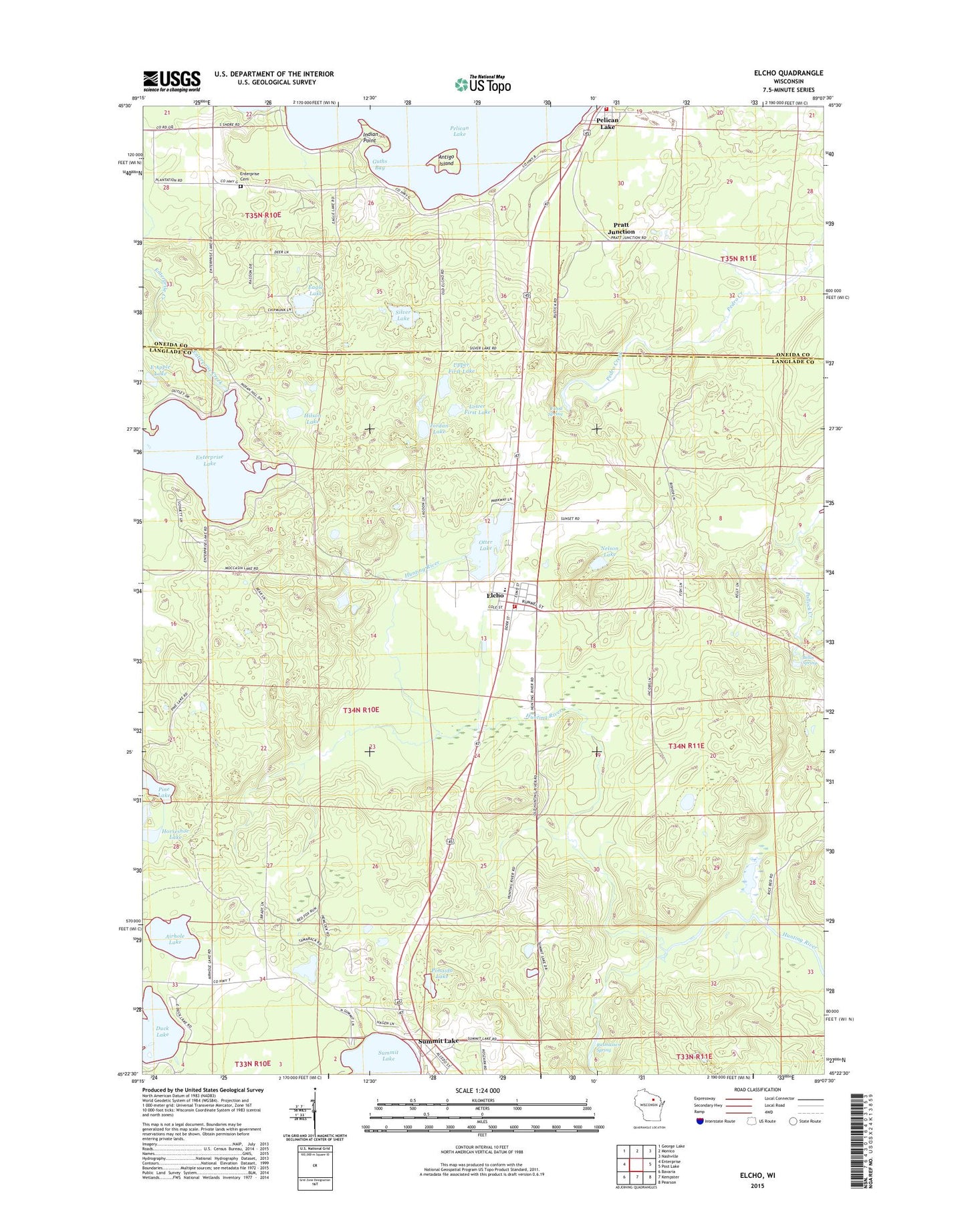
Elcho Wisconsin US Topo Map
Couldn't load pickup availability
2022 topographic map quadrangle Elcho in the state of Wisconsin. Scale: 1:24000. Based on the newly updated USGS 7.5' US Topo map series, this map is in the following counties: Langlade, Oneida. The map contains contour data, water features, and other items you are used to seeing on USGS maps, but also has updated roads and other features. This is the next generation of topographic maps. Printed on high-quality waterproof paper with UV fade-resistant inks.
Quads adjacent to this one:
West: Enterprise
Northwest: George Lake
North: Monico
Northeast: Nashville
East: Post Lake
Southeast: Pearson
South: Kempster
Southwest: Bavaria
This map covers the same area as the classic USGS quad with code o45089d2.
Contains the following named places: Airhole Lake, Antigo Island, Apple Lakes, Bellis Spring, Brady Lake, Duck Lake, Eagle Lake, East Apple Lake, Elcho, Elcho Census Designated Place, Elcho Elementary School, Elcho High School, Elcho Post Office, Elcho Volunteer Fire and Rescue Department, Enterprise Cemetery, Enterprise Lake, Enterprise School, Flood Spring, Guths Bay, Hilson Lake, Indian Point, Jordan Lake, Lower First Lake, Nelson Lake, Oneida County Ambulance Pelican Lake, Otter Lake, Pelican Lake, Pelican Lake Fire District, Pelican Lake Post Office, Pine Lake, Pohaida Lake, Pratt Junction, Rasmussen Spring, Saint Johns Church, Silver Lake, Summit Lake, Summit Lake Census Designated Place, Summit Lake Post Office, Summit Lake Ranger Station, Town of Elcho, Upper First Lake, WZTT-FM (Rhinelander), ZIP Codes: 54428, 54485