MyTopo
Monico Wisconsin US Topo Map
Couldn't load pickup availability
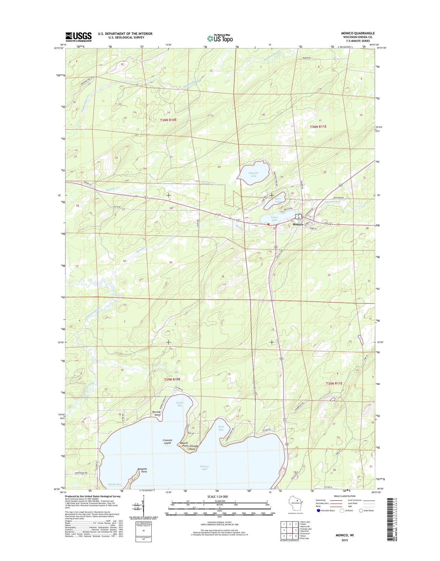
2022 topographic map quadrangle Monico in the state of Wisconsin. Scale: 1:24000. Based on the newly updated USGS 7.5' US Topo map series, this map is in the following counties: Oneida. The map contains contour data, water features, and other items you are used to seeing on USGS maps, but also has updated roads and other features. This is the next generation of topographic maps. Printed on high-quality waterproof paper with UV fade-resistant inks.
Quads adjacent to this one:
West: George Lake
Northwest: Moen Lake
North: Starks
Northeast: Monico NE
East: Nashville
Southeast: Post Lake
South: Elcho
Southwest: Enterprise
This map covers the same area as the classic USGS quad with code o45089e2.
Contains the following named places: Beck Lookout Tower, Chicago Point, Crescent Island, Enterprise Creek, Mars Lake, Mekanac Point, Monico, Monico Creek, Monico Fire Tower, Monico Volunteer Fire Department, Mud Bay, Musky Bay, Neptune Lake, Norway Point, Outlet Bay, Pelican Lake, Pentecost Church, Saint Francis Chapel, Town of Monico, Town of Schoepke, Venus Lake, Weaver Point, ZIP Code: 54463