MyTopo
Gillingham Wisconsin US Topo Map
Couldn't load pickup availability
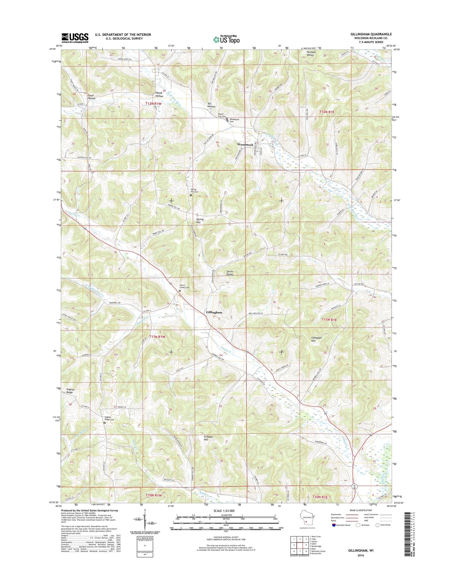
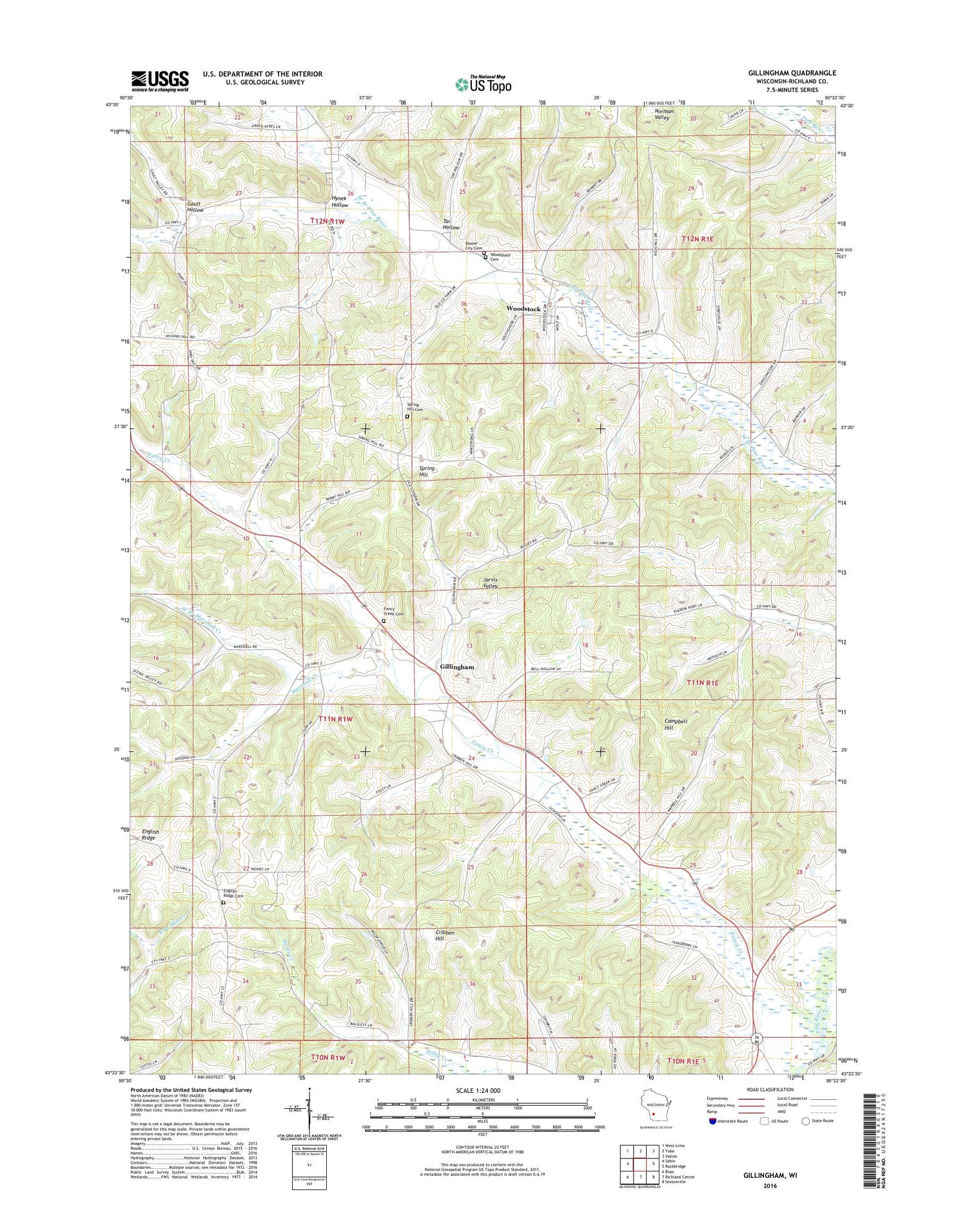
2018 topographic map quadrangle Gillingham in the state of Wisconsin. Scale: 1:24000. Based on the newly updated USGS 7.5' US Topo map series, this map is in the following counties: Richland. The map contains contour data, water features, and other items you are used to seeing on USGS maps, but also has updated roads and other features. This is the next generation of topographic maps. Printed on high-quality waterproof paper with UV fade-resistant inks.
Quads adjacent to this one:
West: Sabin
Northwest: West Lima
North: Yuba
Northeast: Valton
East: Rockbridge
Southeast: Sextonville
South: Richland Center
Southwest: Boaz
Contains the following named places: .36 Reservoir, 0.3 Reservoir, 1 Reservoir, Benton Dale Stock and Grain Farm, Bernstein G-8953 Dam, Beulah Wesleyan Church, Bloom City, Bloom City Cemetery, Bloom City Stock Farm, Campbell Hill, Cribben Hill, Crystal Spring Farm, Elm Hill Short Horn Farm, Elmwood Farm, English Ridge Cemetery, English Ridge School, Evergreen Stock and Dairy Farm, Evergreen Stock Farm, Fancy Creek, Fancy Creek Cemetery, Fancy Creek Church, Fancy Creek Stock Farm, Fishel Homestead, Forest Glen Farm, Gault Hollow, Gault School, Gillingham, Gillingham Homestead, Glen Echo Fruit and Dairy Farm, Glendale Farm, Grand Basin Stock Farm, Green Bluff Farm, Green Hill Farm, Green Mound Stock Farm, Green Valley Stock Farm, Grove Terrace Farm, Hart Homestead, Holstein Stock Farm, Huffman Brothers Dam G7723, Hynek Hollow, Little Valley Stock Farm, Maple Mound Stock Farm, Marshall Creek, McGrew, Mill Creek 13b D-31.11 Dam, Pine Creek Stock Farm, Pine Lawn Stock Farm, Pleasant Heights Stock Farm, Pleasant Valley Farm, Red Barn Stock Farm, Red Oak Stock Farm, Richland County, School Number 2, School Number 3, Shady Lawn Farm, Shady Nook Farm, Shropshire Sheep Farm, Snyders Valley Stock and Dairy Farm, Spring Brook Farm, Spring Brook Stock Farm, Spring Hill, Spring Hill Cemetery, Spring Hill Farm, Spring Hill School, Spring Lawn Stock Farm, Spring Valley Stock Farm, Springhill Field, Sunnyside Stock Farm, Syresville School, Tanglewood Stock Farm, Tar Hollow, Totten Ridge Stock Farm, Town of Marshall, Upper Horse Creek School, Valley View Stock Farm, Walnut Grove Farm, Walnut Grove Stock Farm, West Branch Marshall Creek, West Branch Stock Farm, Willow Grove Farm, Woodstock, Woodstock Cemetery