MyTopo
Yuba Wisconsin US Topo Map
Couldn't load pickup availability
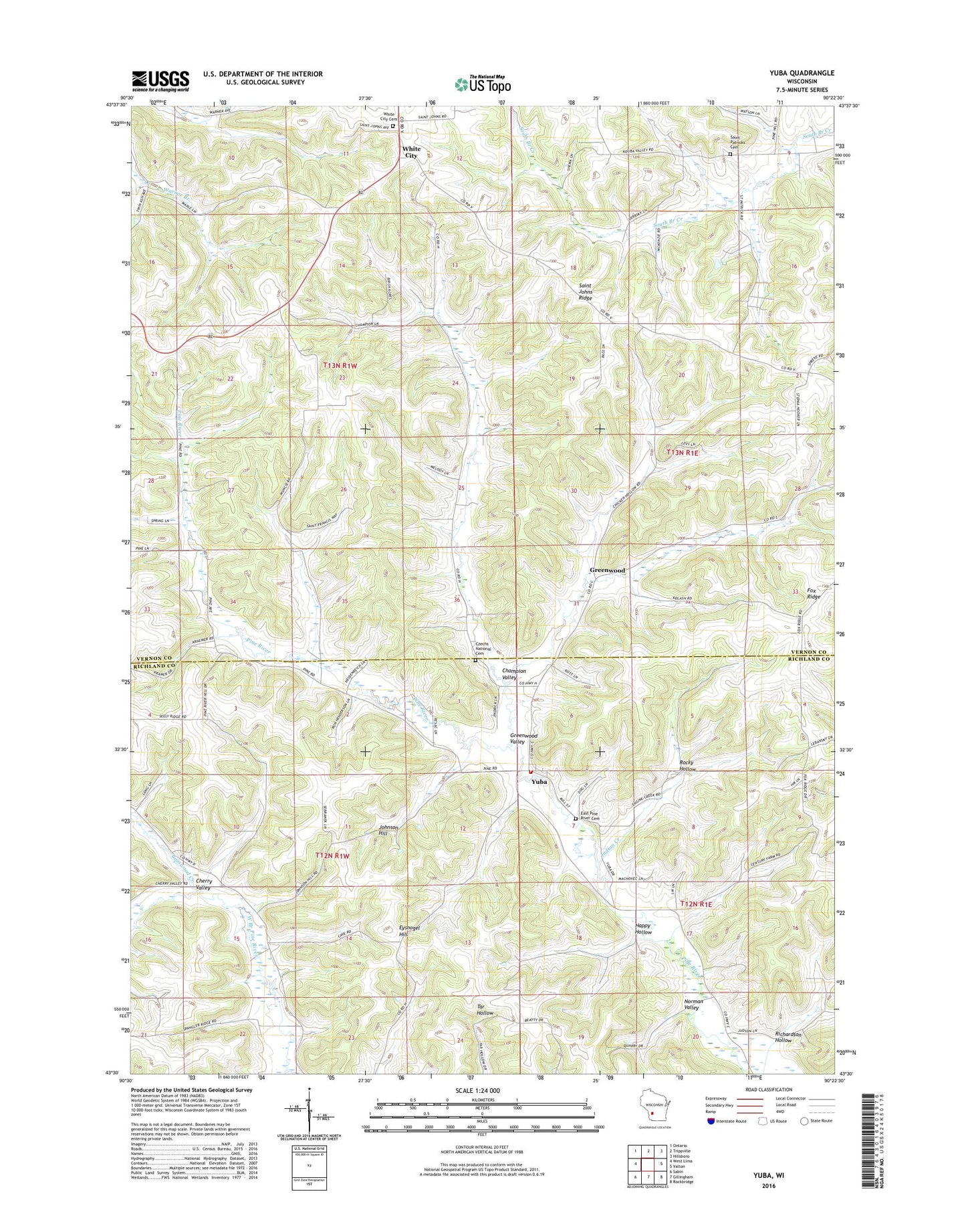
2022 topographic map quadrangle Yuba in the state of Wisconsin. Scale: 1:24000. Based on the newly updated USGS 7.5' US Topo map series, this map is in the following counties: Vernon, Richland. The map contains contour data, water features, and other items you are used to seeing on USGS maps, but also has updated roads and other features. This is the next generation of topographic maps. Printed on high-quality waterproof paper with UV fade-resistant inks.
Quads adjacent to this one:
West: West Lima
Northwest: Ontario
North: Trippville
Northeast: Hillsboro
East: Valton
Southeast: Rockbridge
South: Gillingham
Southwest: Sabin
This map covers the same area as the classic USGS quad with code o43090e4.
Contains the following named places: Basswood Creek, Beranek Stock and Grain Farm, Bloom Center Fruit Farm, Bridgeway Farm, Champion Valley, Cherry Valley, Christian Union Church, Czechs National Cemetery, Deets Stock Farm, East Pine River Cemetery, Evergreen Lawn Farm, Eysnogel Hill, Fairview Farm, Greenwood, Greenwood Valley, Grove Ridge Farm, Happy Hollow, Henrietta, Henrietta School, Herbeck H 208 Dam, Highview Farm, Indian Creek, Indian Creek Farm, Jersey Hill Stock Farm, Johnson Hill, Meadow Brook Farm, Meehoec Stock and Grain Farm, Norman Valley, Oak Ridge Farm, Oakview Farm, Oakwood Farm, Pine River Valley Farm, Pine River View Farm, Pleasant Valley Stock Farm, Richardson Hollow, Rocky Hollow, Rocky Hollow Homestead, Saint Johns Church, Saint Johns Ridge, Saint Patricks Cemetery, School Number 5, School Number 8, Spring Grove Guernsey Farm, Spring Valley Stock and Grain Farm, Sunnyside Farm, Three Springs Farm, Town of Bloom, Town of Union, Twin Springs Farm, Village of Yuba, White City, White City Cemetery, Yuba, Yuba Volunteer Fire Department, ZIP Code: 54634