MyTopo
Grand Marsh Wisconsin US Topo Map
Couldn't load pickup availability
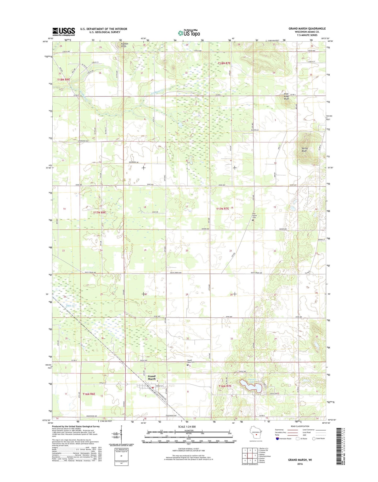
2018 topographic map quadrangle Grand Marsh in the state of Wisconsin. Scale: 1:24000. Based on the newly updated USGS 7.5' US Topo map series, this map is in the following counties: Adams. The map contains contour data, water features, and other items you are used to seeing on USGS maps, but also has updated roads and other features. This is the next generation of topographic maps. Printed on high-quality waterproof paper with UV fade-resistant inks.
Quads adjacent to this one:
West: Adams
Northwest: Roche A Cri
North: Coloma SW
Northeast: Coloma
East: Westfield West
Southeast: Oxford
South: Brooks
Southwest: Easton
Contains the following named places: Fordham, Fordham School, Gould Rock Cemetery, Grand Marsh, Grand Marsh Census Designated Place, Grand Marsh Elementary School, Grand Marsh Post Office, Lincoln School, New Chester Volunteer Fire Department, Patrick Lake, Pilot Knob Bluff, Pine Grove Cemetery, Preston Cliffs, Saint Methodius Church, Spring Bluff, Springbluff, Town of Lincoln