MyTopo
Coloma Wisconsin US Topo Map
Couldn't load pickup availability
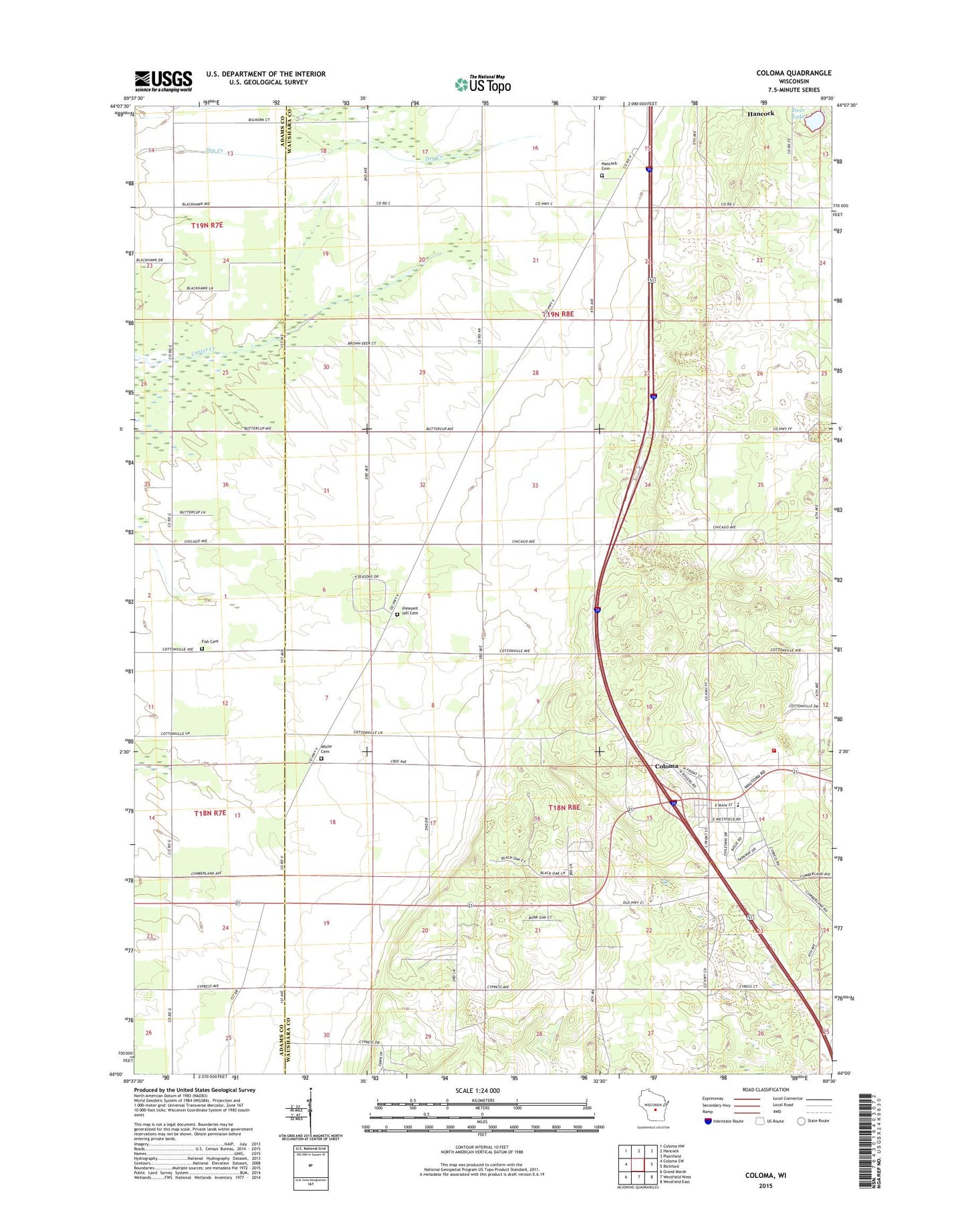
2022 topographic map quadrangle Coloma in the state of Wisconsin. Scale: 1:24000. Based on the newly updated USGS 7.5' US Topo map series, this map is in the following counties: Waushara, Adams. The map contains contour data, water features, and other items you are used to seeing on USGS maps, but also has updated roads and other features. This is the next generation of topographic maps. Printed on high-quality waterproof paper with UV fade-resistant inks.
Quads adjacent to this one:
West: Coloma SW
Northwest: Coloma NW
North: Hancock
Northeast: Plainfield
East: Richford
Southeast: Westfield East
South: Westfield West
Southwest: Grand Marsh
This map covers the same area as the classic USGS quad with code o44089a5.
Contains the following named places: Calvary United Methodist Church, Coloma, Coloma Corners, Coloma Elementary School, Coloma Fire Department, Coloma Municipal Airport, Coloma Police Department, Coloma Post Office, Deer Lake, DeGeorge School, Fish Cemetery, Hancock Cemetery, Pleasant Hill Cemetery, Rox Airport, Town of Coloma, Town of Hancock, Village of Coloma, Waushara County Emergency Medical Services Coloma Division, White Cemetery, ZIP Code: 54930