MyTopo
Kieler Wisconsin US Topo Map
Couldn't load pickup availability
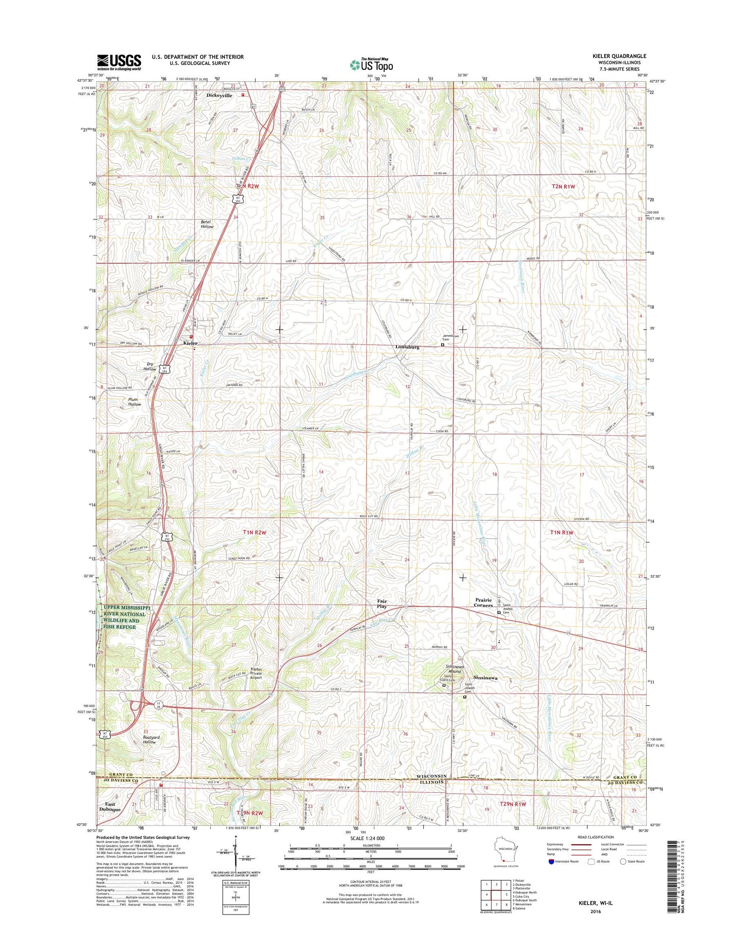
2018 topographic map quadrangle Kieler in the states of Wisconsin, Illinois. Scale: 1:24000. Based on the newly updated USGS 7.5' US Topo map series, this map is in the following counties: Grant, Jo Daviess. The map contains contour data, water features, and other items you are used to seeing on USGS maps, but also has updated roads and other features. This is the next generation of topographic maps. Printed on high-quality waterproof paper with UV fade-resistant inks.
Quads adjacent to this one:
West: Dubuque North
Northwest: Potosi
North: Dickeyville
Northeast: Platteville
East: Cuba City
Southeast: Galena
South: Menominee
Southwest: Dubuque South
Contains the following named places: Beeler Tree Farm, Busy B Farm, Dickeyville Fire and Rescue Department, Dickeyville Wastewater Treatment Facility, Dietzel Farms, Double R Farms, Fair Play, Fair Play Creek, Happy Corners, Hollow Branch, Holy Ghost - Immaculate Conception School, Jamestown, Jamestown Cemetery, Jamestown Fire Department, Kieler, Kieler Census Designated Place, Kieler Creek, Kieler Post Office, Kipp Farms, Kunkel Farms, Louisburg, Louisburg Creek, Maple Leaf Farm, Menominee - Dunleith Fire Department Station 2, Pine Ridge Farm, Placke Farms, Pleasant View Dairy, Prairie Corners, Rigdon Private Airport, Rolling Ridge Ranch, Saint Clara Cemetery, Saint Dominic Cemetery, Saint Joseph Catholic School, Saint Joseph Cemetery, Sandy Hook, Sandy Hook Census Designated Place, Sinsinawa, Sinsinawa Mound, Sinsinawa Post Office, Thommen Farms, Town of Jamestown, Village of Dickeyville, Vosberg Colonial Acres, ZIP Code: 53811