
MyTopo
Lake Eau Claire East Wisconsin US Topo Map
Couldn't load pickup availability
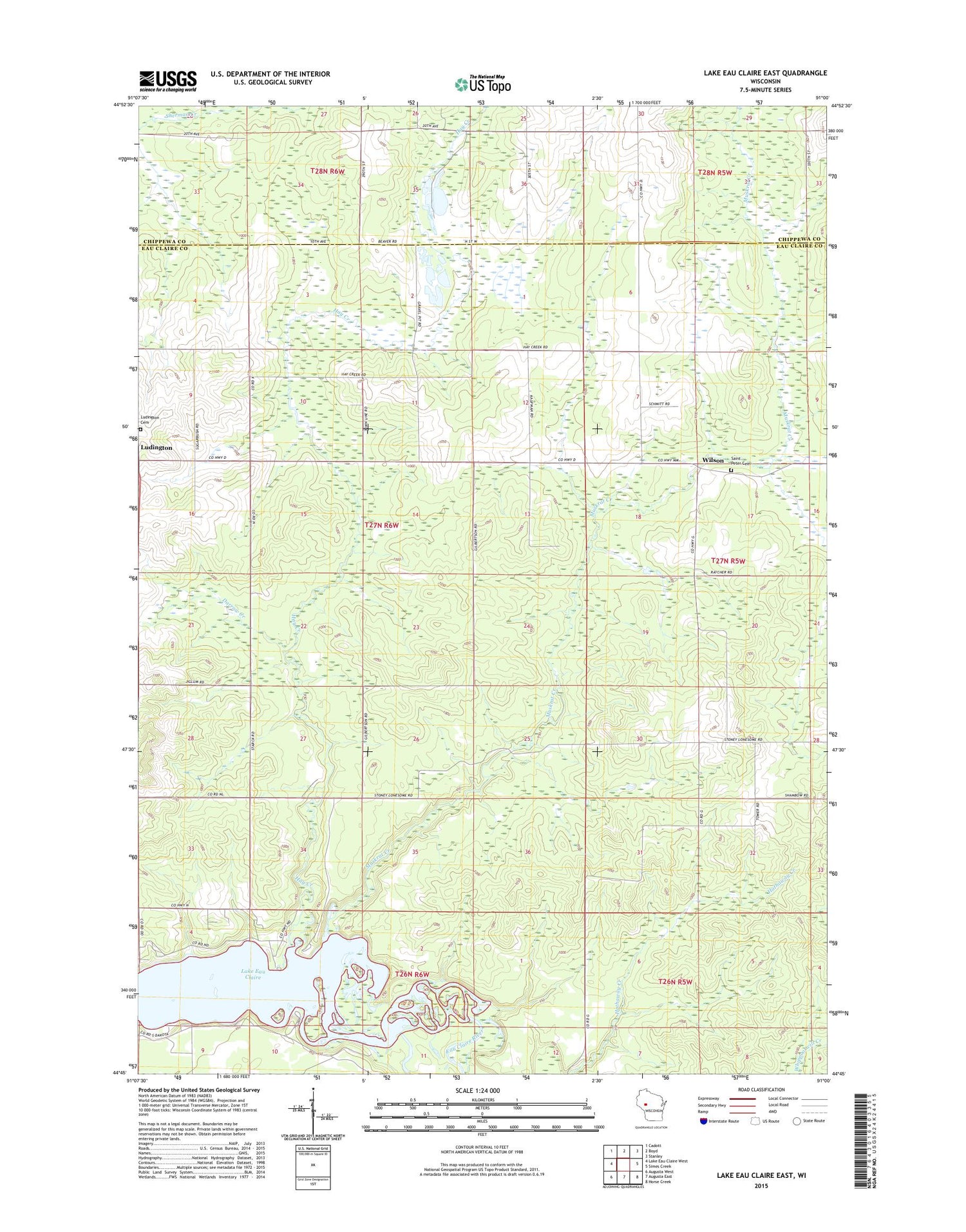
2018 topographic map quadrangle Lake Eau Claire East in the state of Wisconsin. Scale: 1:24000. Based on the newly updated USGS 7.5' US Topo map series, this map is in the following counties: Eau Claire, Chippewa. The map contains contour data, water features, and other items you are used to seeing on USGS maps, but also has updated roads and other features. This is the next generation of topographic maps. Printed on high-quality waterproof paper with UV fade-resistant inks.
Quads adjacent to this one:
West: Lake Eau Claire West
Northwest: Cadott
North: Boyd
Northeast: Stanley
East: Simes Creek
Southeast: Horse Creek
South: Augusta East
Southwest: Augusta West
Contains the following named places: Darrow Creek, Evergreen School, Full Gospel Mission, Grandview School, Hay Creek, Hay Creek Wayside Park, Lake Eau Claire, Lake Eau Claire County Park, Ludington Cemetery, Muskrat Creek, Progress School, Saint Peter Church, Saint Peters Catholic Cemetery, Town of Wilson, Wilson, Wilson Chapel


