MyTopo
Horse Creek Wisconsin US Topo Map
Couldn't load pickup availability
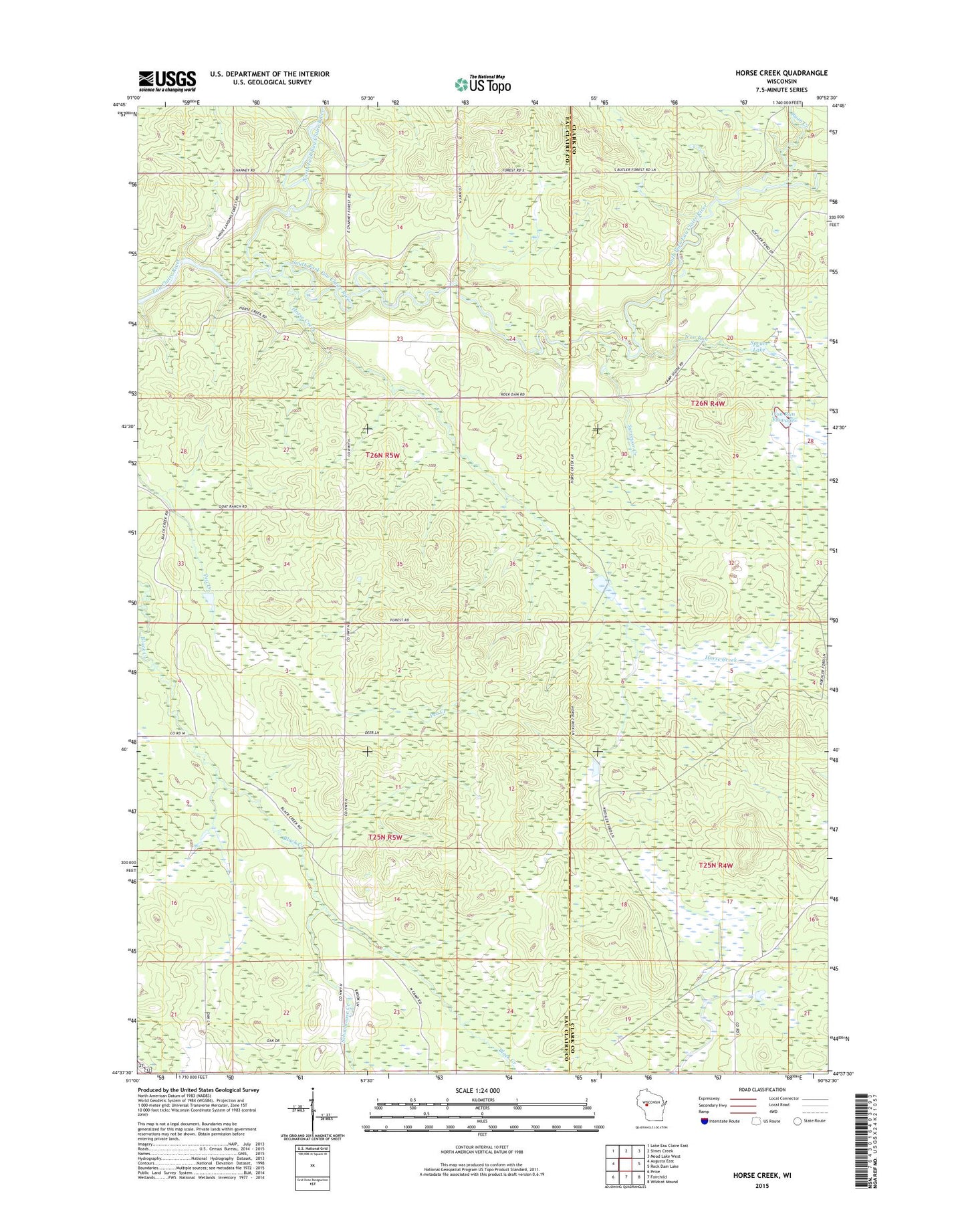
2022 topographic map quadrangle Horse Creek in the state of Wisconsin. Scale: 1:24000. Based on the newly updated USGS 7.5' US Topo map series, this map is in the following counties: Eau Claire, Clark. The map contains contour data, water features, and other items you are used to seeing on USGS maps, but also has updated roads and other features. This is the next generation of topographic maps. Printed on high-quality waterproof paper with UV fade-resistant inks.
Quads adjacent to this one:
West: Augusta East
Northwest: Lake Eau Claire East
North: Simes Creek
Northeast: Mead Lake West
East: Rock Dam Lake
Southeast: Wildcat Mound
South: Fairchild
Southwest: Price
This map covers the same area as the classic USGS quad with code o44090f8.
Contains the following named places: Canoe Landing Prairie State Natural Area, Horse Creek, Iron Run, Iron Run Flowage, Koehler Ford, Melville School, North Fork Eau Claire River, Pea Creek Sedge Meadow State Natural Area, Ryan Creek, Schoolhouse Creek, Smith School, South Fork Barrens State Natural Area, South Fork Eau Claire River, Spruce Lake, Surveyor Creek, Town of Fairchild, WAXX-FM (Eau Claire), WEAU-TV (Eau Claire)