MyTopo
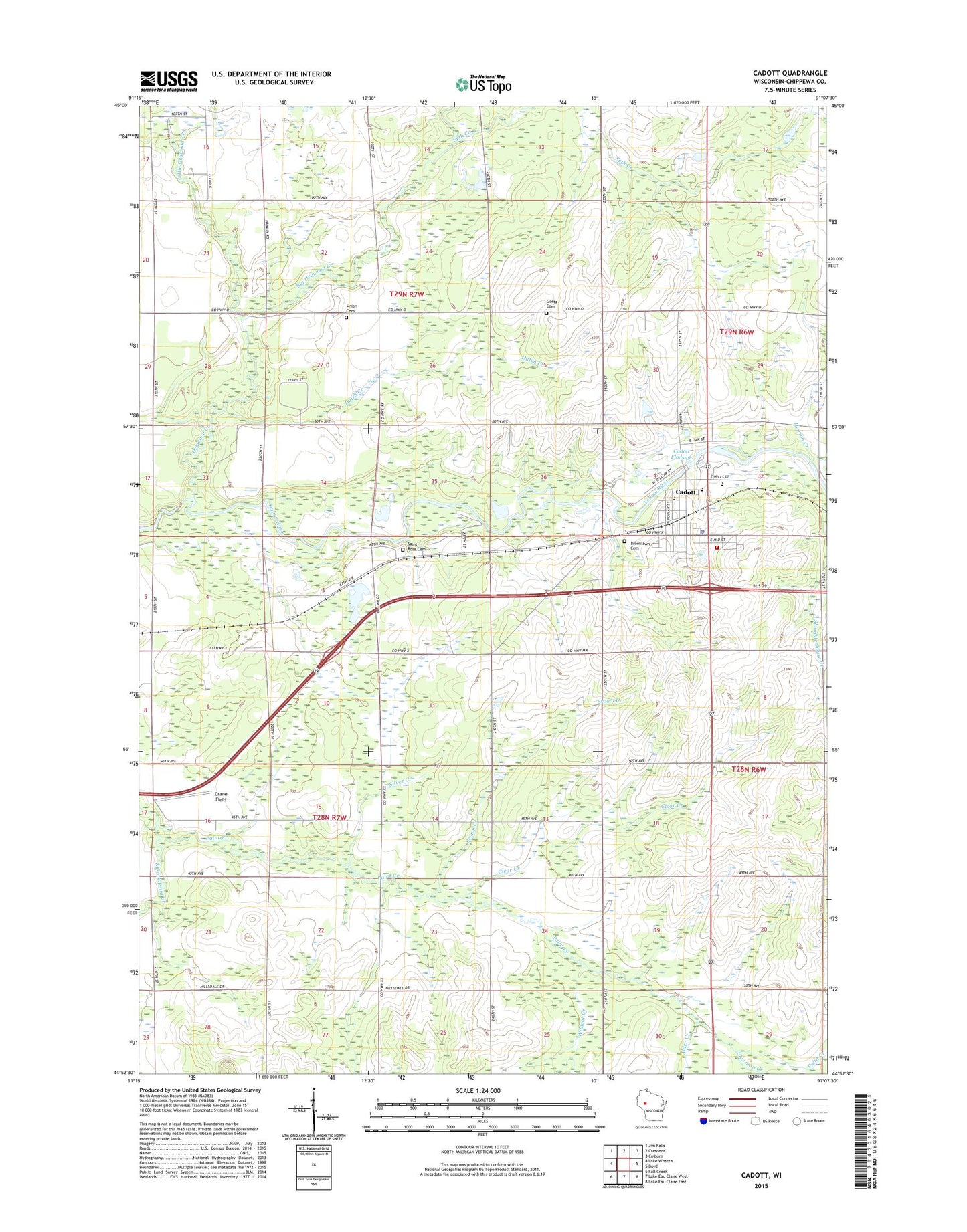
Cadott Wisconsin US Topo Map
Couldn't load pickup availability
2022 topographic map quadrangle Cadott in the state of Wisconsin. Scale: 1:24000. Based on the newly updated USGS 7.5' US Topo map series, this map is in the following counties: Chippewa. The map contains contour data, water features, and other items you are used to seeing on USGS maps, but also has updated roads and other features. This is the next generation of topographic maps. Printed on high-quality waterproof paper with UV fade-resistant inks.
Quads adjacent to this one:
West: Lake Wissota
Northwest: Jim Falls
North: Crescent
Northeast: Colburn
East: Boyd
Southeast: Lake Eau Claire East
South: Lake Eau Claire West
Southwest: Fall Creek
This map covers the same area as the classic USGS quad with code o44091h2.
Contains the following named places: Alder Creek, Baker School, Big Drywood Creek, Brooklawn Cemetery, Brown Creek, Brown School, Cadott, Cadott Area Fire and Rescue, Cadott Elementary School, Cadott Flowage 351, Cadott Junior - Senior High School, Cadott Junior / High School, Cadott Police Department, Cadott Post Office, Clear Creek, Crane Field, Drywood Creek, Dutch Creek, East Anson School, Goetz Cemetery, Hendry School, Hennon Creek, Iron Creek, Lincoln School, Little Drywood Creek, Progressive School, Riverview Park, Saint Joseph School, Saint Rose Cemetery, School Number 7, Seth Creek, Sherman Creek, Silver Creek, South Fork Paint Creek, Svetlik Milling Company Dam, Toutant Pit, Toutant School, Town of Goetz, Town of Sigel, Union Cemetery, Village of Cadott, Wildcat Creek, ZIP Code: 54727