
MyTopo
Lake Julia Wisconsin US Topo Map
Couldn't load pickup availability
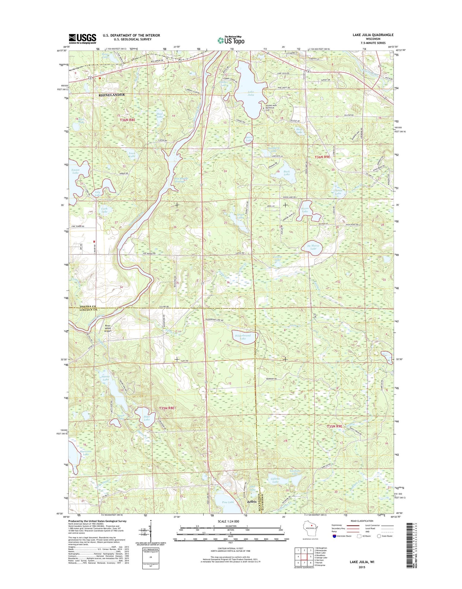
2018 topographic map quadrangle Lake Julia in the state of Wisconsin. Scale: 1:24000. Based on the newly updated USGS 7.5' US Topo map series, this map is in the following counties: Oneida, Lincoln. The map contains contour data, water features, and other items you are used to seeing on USGS maps, but also has updated roads and other features. This is the next generation of topographic maps. Printed on high-quality waterproof paper with UV fade-resistant inks.
Quads adjacent to this one:
West: Woodboro
Northwest: McNaughton
North: Rhinelander
Northeast: Moen Lake
East: George Lake
Southeast: Enterprise
South: Parrish
Southwest: Harrison
Contains the following named places: Abel Lake, Alice Lake, Buck Lake, Camp Six Creek, Carlson Creek, Cook Lake, Crescent Corner, Crescent Creek, Crescent Elementary School, Crescent Fire Department Station 1, Crescent Fire Department Station 2, Cuenin Lake, Davis Lake, De Marce Lake, Emma Lake, Fawn Lake, Ferndale School, Gillette Lake, Gross Lake, Gross School, Hardell Creek, Hat Rapids 1903c239 Dam, Hat Rapids Flowage, Hat Rapids Flowage 1143, Heal Creek, Heal Lake, Hess Lake, Hilderbrand Lake, Hilts Lake, Hixon Lake, Hoist Lake, Jeffris, Lake Julia, Landberg Lake, Lassig Creek, Lassig Lake, Lily Lake, Little Pine Creek, Loon Lake, Nicolet Technical College, Noisy Creek, Our Saviour Church, Pine Lake, River Valley Airport, Smallpox Creek, Squaw Creek, Squaw Lake, Timber Lake, Town of Crescent, Trotier School, Wickham Lake


