MyTopo
McNaughton Wisconsin US Topo Map
Couldn't load pickup availability
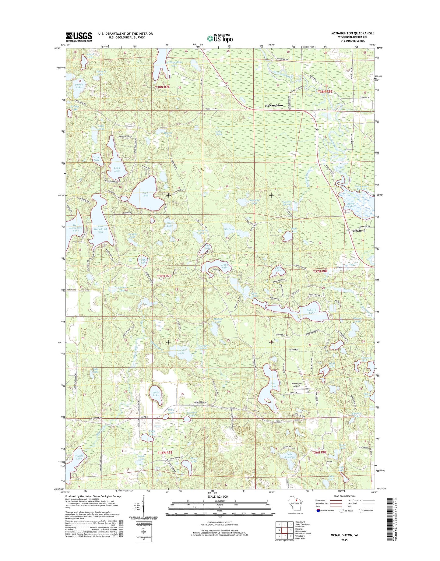
2022 topographic map quadrangle McNaughton in the state of Wisconsin. Scale: 1:24000. Based on the newly updated USGS 7.5' US Topo map series, this map is in the following counties: Oneida. The map contains contour data, water features, and other items you are used to seeing on USGS maps, but also has updated roads and other features. This is the next generation of topographic maps. Printed on high-quality waterproof paper with UV fade-resistant inks.
Quads adjacent to this one:
West: Harshaw
Northwest: Hazelhurst
North: Lake Tomahawk
Northeast: Dam Lake
East: Rhinelander
Southeast: Lake Julia
South: Woodboro
Southwest: Heafford Junction
This map covers the same area as the classic USGS quad with code o45089f5.
Contains the following named places: Alva Lake, Beaver Lake, Beaver Lake School, Bobs Lake, Cassian-Woodboro County Recreation Area, Cedar Spring, Cedar Spring Creek, Cherry Lake, Clear Lake, Coon Lake, Corner Lake, East Horsehead Lake, Elna Lake, Flag Lake, Garland Lake, Germain Hemlocks State Natural Area, Goodyear Creek, Goodyear Lake, Goodyear Springs, Hodag Lake, Hook Lake, Island Lake, John Lake, Josie Lake, Lake Samway, Liege Lake, Long Lake, Lorraine Lake, Lumen Lake, Lyle Lake, Maud Lake, McNaughton, McNaughton Lake, Mildred Lake, Newbold, Newbold Lake, Newbold Spring Creek, Newbold Springs, Ole Lake, Oneida County, Perch Lake, Pine Grove Airport, Pritch Lake, Roby Lake, Rudy Lake, Shadow Lake, Soo Lake, Spruce Lake, Spruce Lake E1176.2 Dam, Swamp Lake, Thoreau Lake, Timber Lake, Tyler Lake, West Horsehead Lake, Whitey Lake