MyTopo
Woodboro Wisconsin US Topo Map
Couldn't load pickup availability
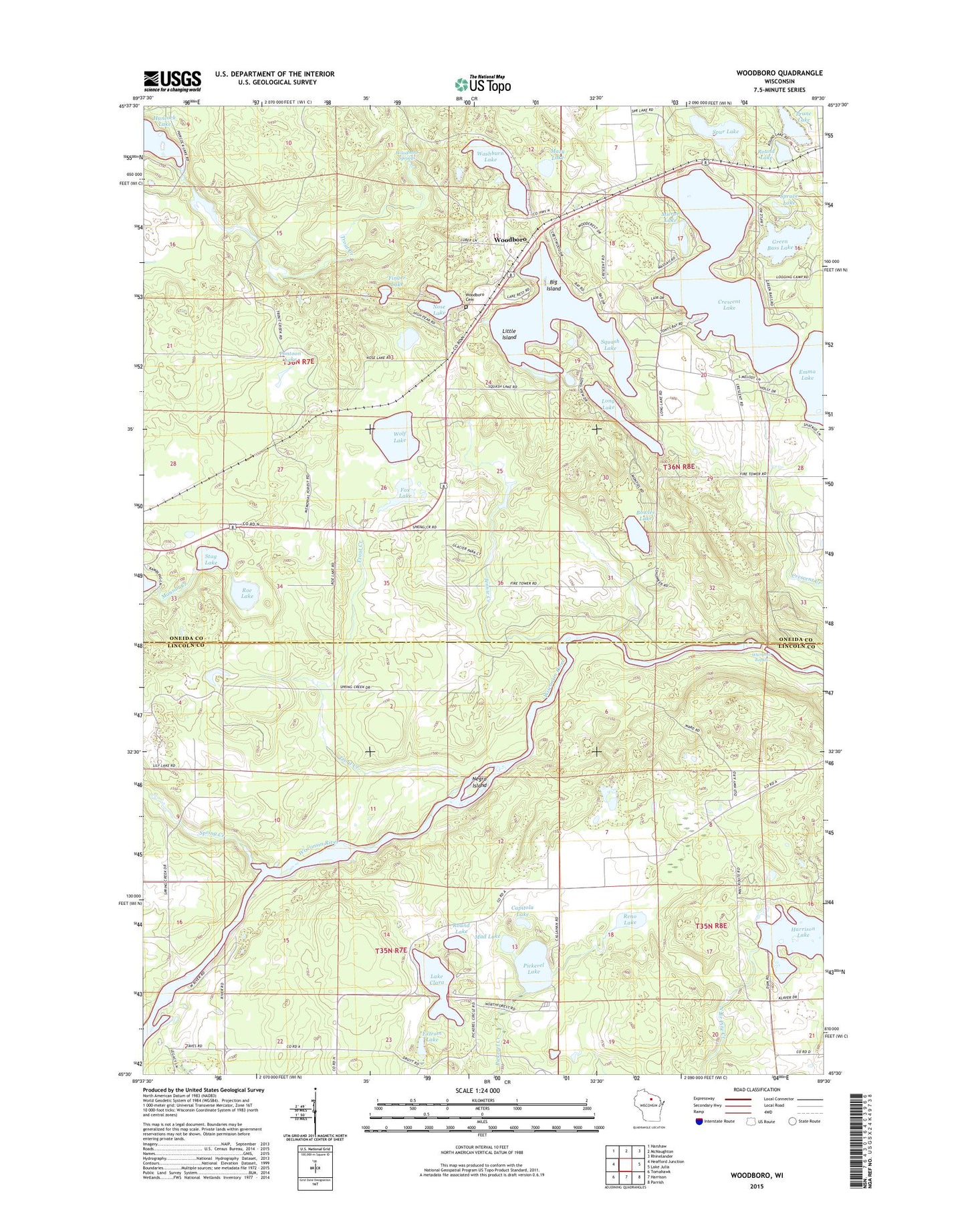
2022 topographic map quadrangle Woodboro in the state of Wisconsin. Scale: 1:24000. Based on the newly updated USGS 7.5' US Topo map series, this map is in the following counties: Oneida, Lincoln. The map contains contour data, water features, and other items you are used to seeing on USGS maps, but also has updated roads and other features. This is the next generation of topographic maps. Printed on high-quality waterproof paper with UV fade-resistant inks.
Quads adjacent to this one:
West: Heafford Junction
Northwest: Harshaw
North: McNaughton
Northeast: Rhinelander
East: Lake Julia
Southeast: Parrish
South: Harrison
Southwest: Tomahawk
This map covers the same area as the classic USGS quad with code o45089e5.
Contains the following named places: Big Island, Bowles Lake, Camp Ten Lookout Tower, Capitola Lake, Crescent Flats School, Crescent Lake, Extrom Lake, Finger Lake, Fox Lake, Green Bass Lake, Harrison 2WP351 Dam, Harrison Lake, Harrison Lake 6, Highland Flats School, Jennie Creek, Lake Clara, Little Island, Long Lake, Mazy Lake, Mirror Lake, Mud Lake, Negro Island, Nose Lake, Pickerel Lake, Pontoon Lake, Porcupine Lookout Tower, Prune Lake, Reno Lake, Roe Lake, Round Lake, Spring Creek, Spruce Lake, Spur Lake, Squash Lake, Stag Lake, Town of King, Town of Woodboro, Trout Creek, Washburn Lake, Whirlpool Rapids, Wolf Lake, Woodboro, Woodboro Cemetery, Woodboro Springs