MyTopo
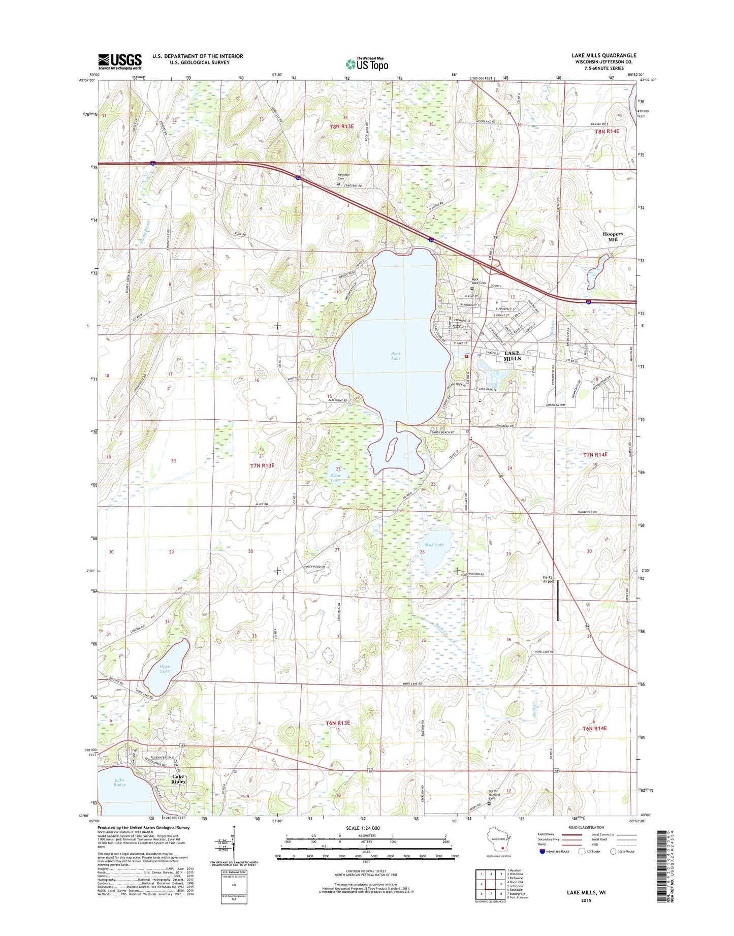
Lake Mills Wisconsin US Topo Map
Couldn't load pickup availability
2018 topographic map quadrangle Lake Mills in the state of Wisconsin. Scale: 1:24000. Based on the newly updated USGS 7.5' US Topo map series, this map is in the following counties: Jefferson. The map contains contour data, water features, and other items you are used to seeing on USGS maps, but also has updated roads and other features. This is the next generation of topographic maps. Printed on high-quality waterproof paper with UV fade-resistant inks.
Quads adjacent to this one:
West: Deerfield
Northwest: Marshall
North: Waterloo
Northeast: Richwood
East: Jefferson
Southeast: Fort Atkinson
South: Busseyville
Southwest: Rockdale
Contains the following named places: Badger School, Bean Lake, Bean Lake State Natural Area, Breezy Knoll, Brick Street School, City of Lake Mills, Faville Grove School, Flanagan School, Ha-Rail Airport, Harvey School, Hoopers Dam, Hoopers Mill, Hoopers Millpond 16, Hope Lake, Lake Mills, Lake Mills Elementary School, Lake Mills Emergency Medical Services, Lake Mills Fire Department, Lake Mills High School, Lake Mills Middle School, Lake Mills Police Department, Lake Mills Post Office, Lake Mills Town Police Department, Lake Mills Wastewater Treatment Plant, Lake Ripley, Lake Ripley Census Designated Place, Lakeside Lutheran High School, Lakeside Park, Mankowski Quarry, Mud Lake, North Oakland Cemetery, Oakland 3 WR 1801 Dam, Oakland Police Department, Perch Lake, Plainview School, Rock Lake, Rock Lake Cemetery, Saint Johns Lutheran Cemetery, Saint Paul Evangelical Lutheran School, Stony Brook School, Town of Lake Mills, Townline School, ZIP Code: 53551