MyTopo
Richwood Wisconsin US Topo Map
Couldn't load pickup availability
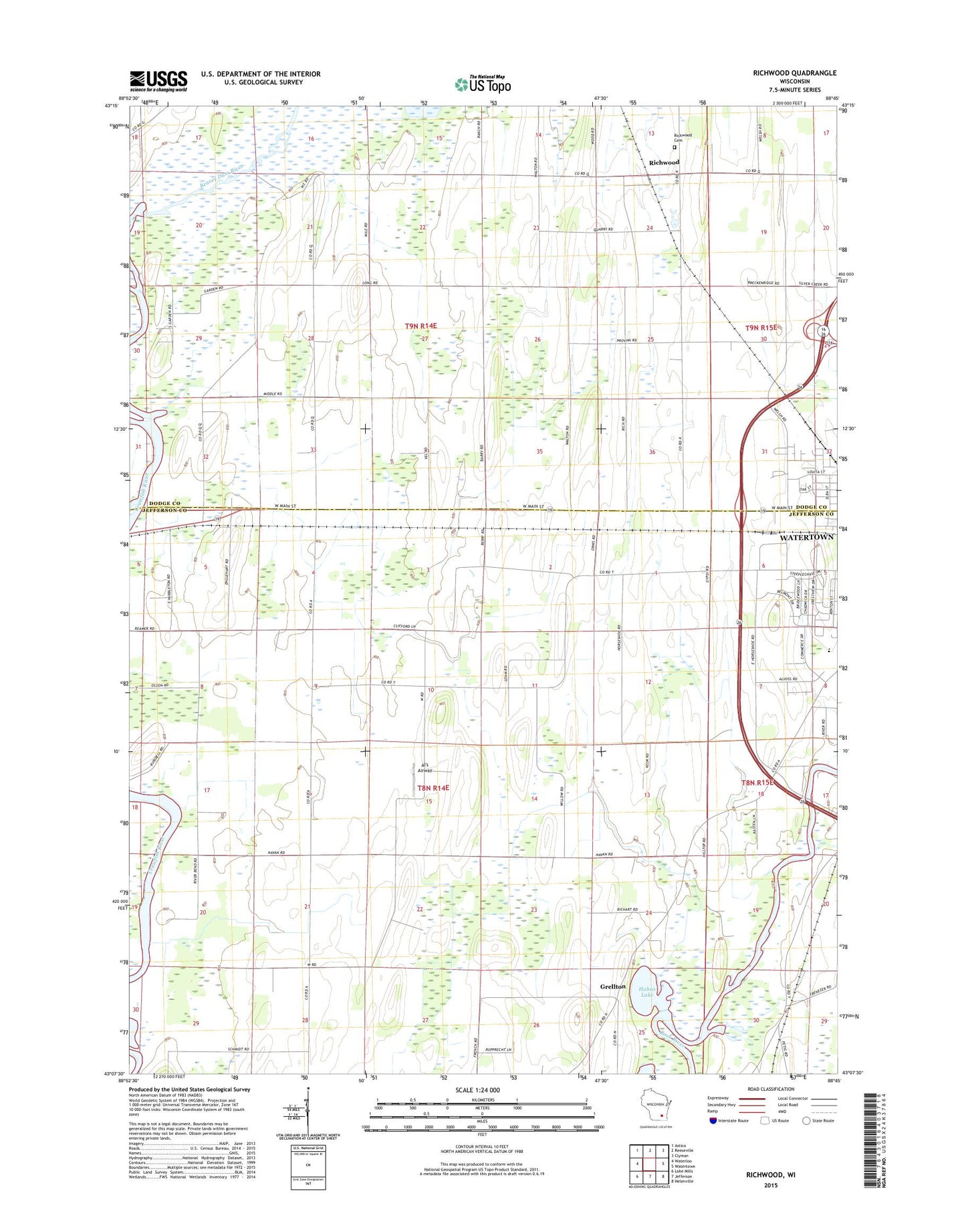
2022 topographic map quadrangle Richwood in the state of Wisconsin. Scale: 1:24000. Based on the newly updated USGS 7.5' US Topo map series, this map is in the following counties: Jefferson, Dodge. The map contains contour data, water features, and other items you are used to seeing on USGS maps, but also has updated roads and other features. This is the next generation of topographic maps. Printed on high-quality waterproof paper with UV fade-resistant inks.
Quads adjacent to this one:
West: Waterloo
Northwest: Astico
North: Reeseville
Northeast: Clyman
East: Watertown
Southeast: Helenville
South: Jefferson
Southwest: Lake Mills
This map covers the same area as the classic USGS quad with code o43088b7.
Contains the following named places: Al's Airway, Beaver Dam River, Calvary Baptist Christian School, Elm Grove School, Grellton, Hahns Lake, Heitz School, Hickory Grove School, Hilltop School, Mamre Church, Mamre Moravian Cemetery, Richwood, Richwood Cemetery, Richwood School, Saint Marks School, Town of Milford, Town of Shields, WTTN-AM (Watertown)