MyTopo
Lima Center Wisconsin US Topo Map
Couldn't load pickup availability
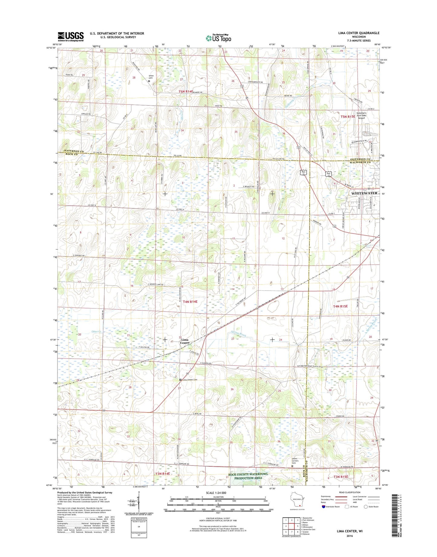
2018 topographic map quadrangle Lima Center in the state of Wisconsin. Scale: 1:24000. Based on the newly updated USGS 7.5' US Topo map series, this map is in the following counties: Rock, Jefferson, Walworth. The map contains contour data, water features, and other items you are used to seeing on USGS maps, but also has updated roads and other features. This is the next generation of topographic maps. Printed on high-quality waterproof paper with UV fade-resistant inks.
Quads adjacent to this one:
West: Milton
Northwest: Busseyville
North: Fort Atkinson
Northeast: Rome
East: Whitewater
Southeast: Delavan
South: Avalon
Southwest: Janesville East
Contains the following named places: Gutzmer's Twin Oaks Airport, Koshkonong Union Cemetery, Lauer Willis Farm, Lima Bog State Natural Area, Lima Center, Lima Center Cemetery, North Lima Church, Onyx Valley Metal Landfill, Pond Hill Dairy Farm, Saint Patricks Catholic Church, Town of Lima, Twin Lakes Mobile Home Park, Utters Corners, Utters Corners Cemetery, Whitewater High School, Whitewater Middle School, Wolf's Mobile Home Park, Wright's Mobile Home Park, WSJY-FM (Fort Atkinson)