MyTopo
Lime Ridge Wisconsin US Topo Map
Couldn't load pickup availability
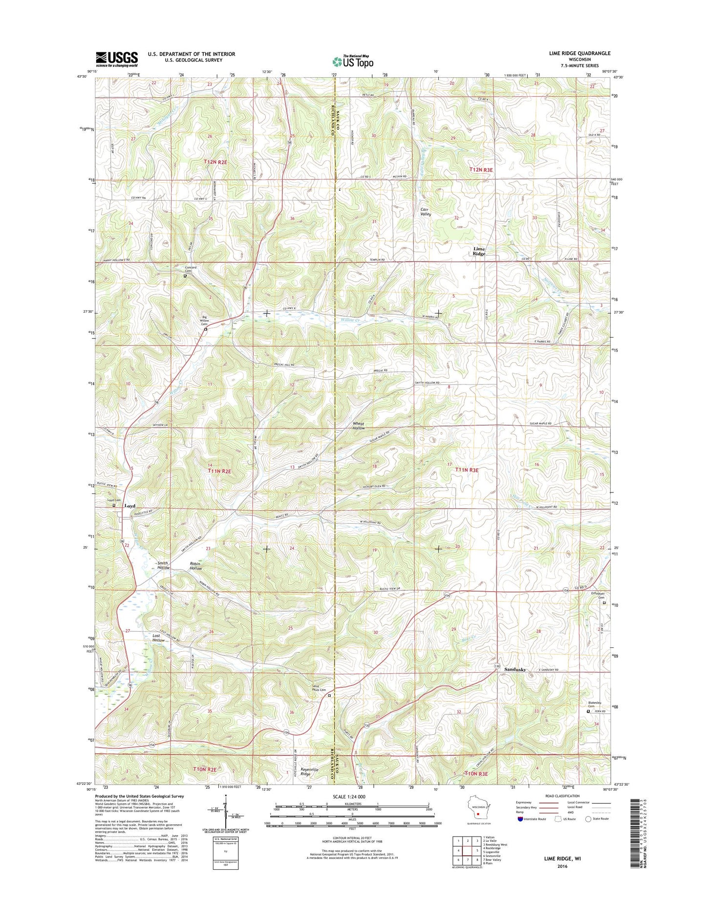
2022 topographic map quadrangle Lime Ridge in the state of Wisconsin. Scale: 1:24000. Based on the newly updated USGS 7.5' US Topo map series, this map is in the following counties: Sauk, Richland. The map contains contour data, water features, and other items you are used to seeing on USGS maps, but also has updated roads and other features. This is the next generation of topographic maps. Printed on high-quality waterproof paper with UV fade-resistant inks.
Quads adjacent to this one:
West: Rockbridge
Northwest: Valton
North: La Valle
Northeast: Reedsburg West
East: Loganville
Southeast: Plain
South: Bear Valley
Southwest: Sextonville
This map covers the same area as the classic USGS quad with code o43090d2.
Contains the following named places: Big Willow Creek Stock Farm, Blakeslee Cemetery, Block School, Blue Silo Stock Farm, Butternut School, Concord Cemetery, Concord Church, Elm Grove School, Erffmeyer Cemetery, Fairview Grain and Hop Farm, Far View Farm, Harris School, Larch Fruit Farm, Lime Ridge, Lime Ridge Post Office, Lost Hollow, Loyd, Loyd Cemetery, Maple Grove Stock Farm, Meyers School, Oakwood Dairy Farm, Pine Crest School, Plain View School, Plainview Dairy and Grain Farm, Pleasant Valley Dairy Farm, Robin Hollow, Saint Paul Lutheran Cemetery, Saint Pauls Church, Sandusky, Smith Hollow, Smith Hollow School, Spring Brook Farm, Spring Valley Stock Farm, Town of Washington, Union Church, Upper Big Willow Cemetery, Valley View Farm, Village of Lime Ridge, Wards Corners, Weston Elementary School, Weston High School, Weston Junior High School, White School, Willow Stock Farm, Woods Homestead, ZIP Code: 53937