MyTopo
Luxemburg Wisconsin US Topo Map
Couldn't load pickup availability
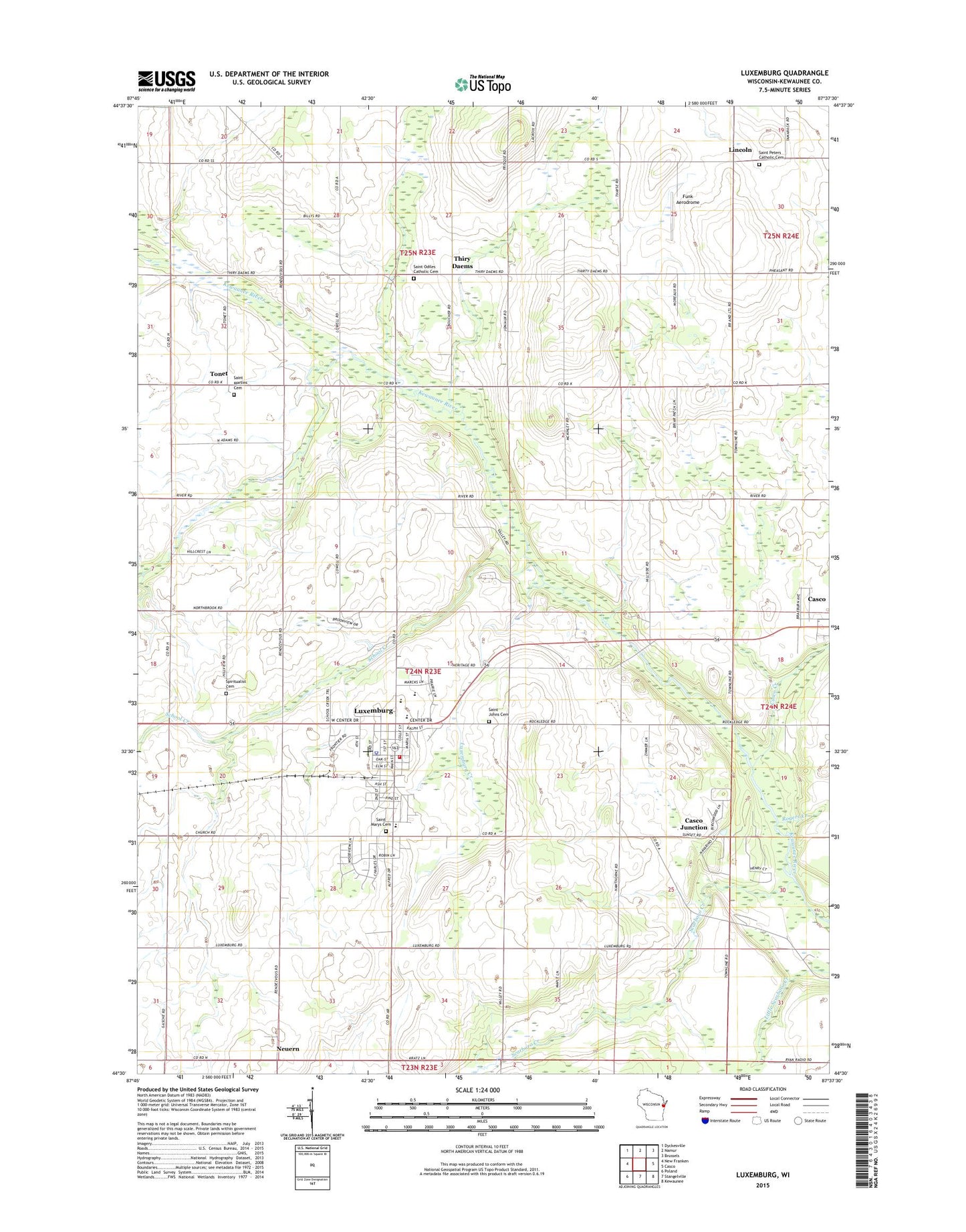
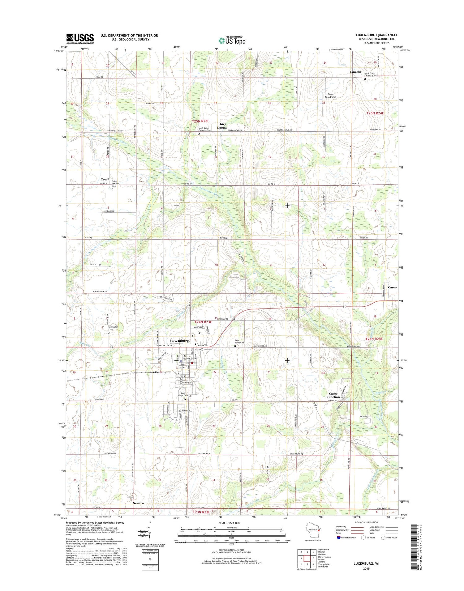
2018 topographic map quadrangle Luxemburg in the state of Wisconsin. Scale: 1:24000. Based on the newly updated USGS 7.5' US Topo map series, this map is in the following counties: Kewaunee. The map contains contour data, water features, and other items you are used to seeing on USGS maps, but also has updated roads and other features. This is the next generation of topographic maps. Printed on high-quality waterproof paper with UV fade-resistant inks.
Quads adjacent to this one:
West: New Franken
Northwest: Dyckesville
North: Namur
Northeast: Brussels
East: Casco
Southeast: Kewaunee
South: Stangelville
Southwest: Poland
Contains the following named places: Blue View Dairy Farms, Casco Creek, Casco Junction, Frog Station, Funk Aerodrome, Garfield School, Grant School, Haen Acres, Hallet Dairy Farm, Hawthorne School, Holmes School, J - Mar Hillside Acres, Junion Homestead Farm, Lincoln, Lincoln Chapel, Little Scarboro State Public Fishery Area, Lowell School, Luxemburg, Luxemburg - Casco High School, Luxemburg - Casco Intermediate School, Luxemburg - Casco Primary School, Luxemburg Creek, Luxemburg Emergency and Rescue Services, Luxemburg Fire Department, Luxemburg Police Department, Luxemburg Post Office, Martinville School, McKinley School, Miesler Farms, Neuern, North Brook Country Club, Rogers Creek, Saint John's Lutheran Cemetery, Saint Johns Lutheran Church, Saint Martin Catholic Church, Saint Martins Cemetery, Saint Mary Catholic Church, Saint Mary School, Saint Mary's Cemetery, Saint Odile Catholic Church, Saint Odiles Cemetery, Saint Peter Catholic Church, Saint Peters Catholic Cemetery, Scarboro Creek, School Creek, Spiritualist Cemetery, Theys Orchard, Thiry Daems, Tonet, Town of Luxemburg, Village of Luxemburg, Walhain School, Washington School, ZIP Codes: 54205, 54217