MyTopo
Mercer Lake Wisconsin US Topo Map
Couldn't load pickup availability
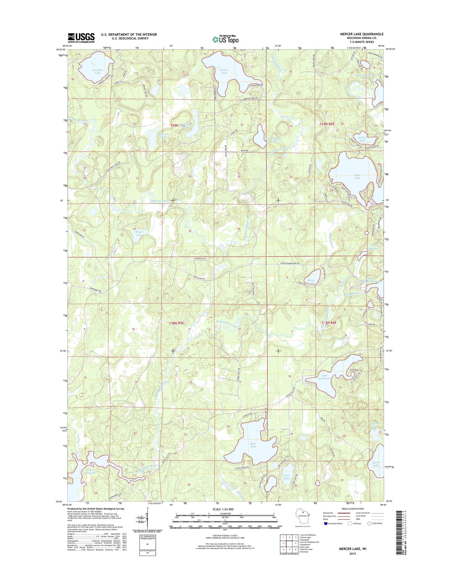
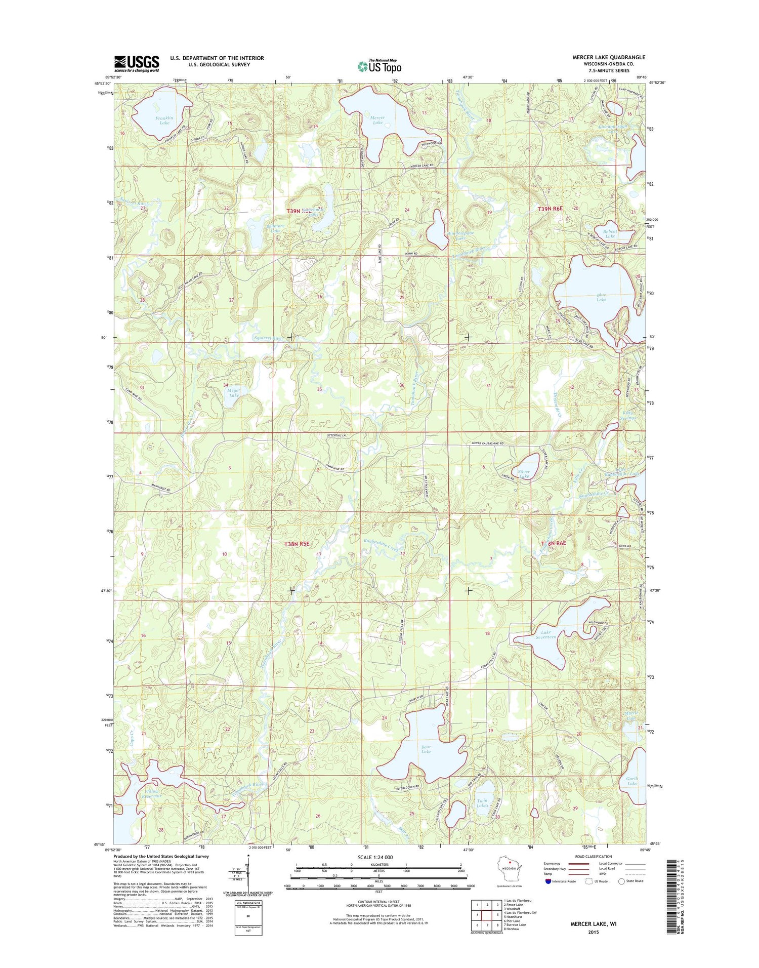
2018 topographic map quadrangle Mercer Lake in the state of Wisconsin. Scale: 1:24000. Based on the newly updated USGS 7.5' US Topo map series, this map is in the following counties: Oneida. The map contains contour data, water features, and other items you are used to seeing on USGS maps, but also has updated roads and other features. This is the next generation of topographic maps. Printed on high-quality waterproof paper with UV fade-resistant inks.
Quads adjacent to this one:
West: Lac du Flambeau SW
Northwest: Lac du Flambeau
North: Fence Lake
Northeast: Woodruff
East: Hazelhurst
Southeast: Harshaw
South: Burrows Lake
Southwest: Pier Lake
Contains the following named places: Bear Lake, Bellmore Lake, Blue Lake, Bobcat Lake, Caps Creek, Franklin Lake, Garth Lake, Howards Creek, Kaubashine Creek, Kitty Creek, Kitty Springs, Lake Seventeen, Mercer Lake, Meyer Lake, Myrtle Lake, Scotchman Lake, Silver Lake, Squirrel River, Squirrel River Pines State Natural Area, Threemile Creek, Tomahawk River Pines State Natural Area, Twin Lakes, Windowpane Lake, ZIP Codes: 54531, 54548